No higher resolution available.
Pindus_map.JPG (416 × 377 pixels, file size: 43 KB, MIME type: image/jpeg)
| This is a file from the Wikimedia Commons. Information from its description page there is shown below. Commons is a freely licensed media file repository. You can help. |
Summary
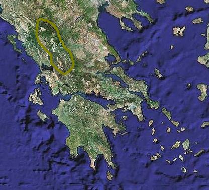
| Description |
English: Map of Pindus mountain Ελληνικά: Χάρτης της Πίνδου |
| Source | File:Greece-satellite-map.jpg |
| Author | NASA |
Licensing
| This file is in the public domain in the United States because it was solely created by NASA. NASA copyright policy states that "NASA material is not protected by copyright unless noted". (See Template:PD-USGov, NASA copyright policy page or JPL Image Use Policy.) | ||
 |
Warnings:
|
Original upload log
Transferred from el.wikipedia to Commons by MARKELLOS using CommonsHelper.
The original description page was here. All following user names refer to el.wikipedia.
- 2010-08-08 15:01 Costas78 416×377× (44297 bytes) {{Πληροφορίες εικόνας |Περιγραφή=Χάρτης Πίνδου |Πηγή=βασισμένη στην εικόνα Greece-satellite-map.jpg |Ημερομηνία=8-8-2010 |Δημιουργός=Costas78 |Άδεια χρήσης= }}
File history
Click on a date/time to view the file as it appeared at that time.
| Date/Time | Thumbnail | Dimensions | User | Comment | |
|---|---|---|---|---|---|
| current | 19:07, 27 December 2011 | | 416 × 377 (43 KB) | File Upload Bot (Magnus Manske) | {{BotMoveToCommons|el.wikipedia|year={{subst:CURRENTYEAR}}|month={{subst:CURRENTMONTHNAME}}|day={{subst:CURRENTDAY}}}} {{Information |Description={{el|''no original description''}} |Source=Transferred from [http://el.wikipedia.org el.wikipedia]; transfer |
File usage
The following pages on the English Wikipedia use this file (pages on other projects are not listed):
Global file usage
The following other wikis use this file:
- Usage on bg.wikipedia.org
- Usage on de.wikivoyage.org
- Usage on el.wikipedia.org
- Usage on hyw.wikipedia.org
- Usage on nl.wikipedia.org
- Usage on nn.wikipedia.org
- Usage on sl.wikipedia.org
- Usage on sv.wikipedia.org