Size of this preview: 800 × 438 pixels. Other resolutions: 320 × 175 pixels | 640 × 351 pixels | 1,024 × 561 pixels | 1,280 × 701 pixels | 2,511 × 1,376 pixels.
Original file (2,511 × 1,376 pixels, file size: 5.46 MB, MIME type: image/png)
| This is a file from the Wikimedia Commons. Information from its description page there is shown below. Commons is a freely licensed media file repository. You can help. |
Summary
| Description |
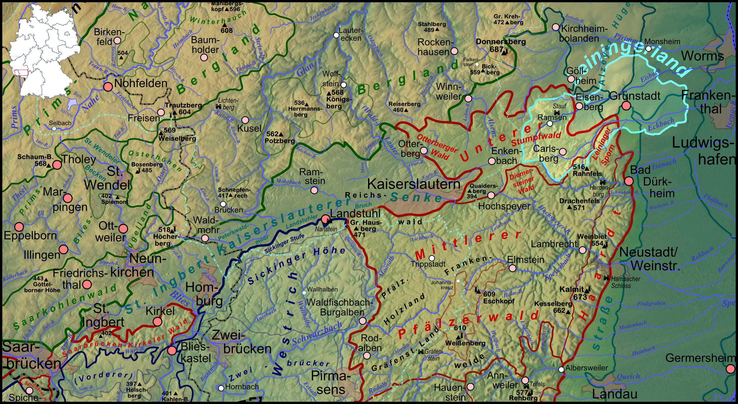
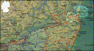
Deutsch: Lagekarte des Leiningerlandes (aufgehellt) im äußersten Nordosten bis nordöstlich des Pfälzerwaldes |
| Date | |
| Source |
Own work
|
| Author | Elop, based on work by Lencer |
| Other versions |
|
Licensing

|
Permission is granted to copy, distribute and/or modify this document under the terms of the GNU Free Documentation License, Version 1.2 or any later version published by the Free Software Foundation; with no Invariant Sections, no Front-Cover Texts, and no Back-Cover Texts. A copy of the license is included in the section entitled GNU Free Documentation License. |
File history
Click on a date/time to view the file as it appeared at that time.
| Date/Time | Thumbnail | Dimensions | User | Comment | |
|---|---|---|---|---|---|
| current | 21:54, 8 February 2012 | | 2,511 × 1,376 (5.46 MB) | Elop | komplettes Update |
| 01:37, 17 December 2011 |  | 1,382 × 1,137 (2.31 MB) | Elop | Update | |
| 18:24, 11 December 2011 |  | 1,382 × 1,137 (2.26 MB) | Elop | == Summary == {{Information |Description ={{de|1=Lagekarte des de:Leiningerlandes (farblich hervorgehoben) im äußersten Nordosten bis nordöstlich des Pfälzerwaldes}} |Source ={{own}} *[[:File:Karte Pfälzerwald.pn |
File usage
The following pages on the English Wikipedia use this file (pages on other projects are not listed):
Global file usage
The following other wikis use this file:
- Usage on de.wikipedia.org
- Usage on fr.wikipedia.org
- Usage on ru.wikipedia.org