
Size of this preview: 800 × 535 pixels. Other resolutions: 320 × 214 pixels | 640 × 428 pixels | 1,024 × 685 pixels | 1,170 × 783 pixels.
Original file (1,170 × 783 pixels, file size: 1.68 MB, MIME type: image/jpeg)
| This is a file from the Wikimedia Commons. Information from its description page there is shown below. Commons is a freely licensed media file repository. You can help. |
Summary
| Camera location | | View this and other nearby images on: OpenStreetMap |
|---|
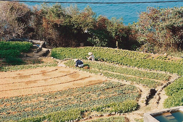
| Description | Market gardening in Pak Kok Tsuen (village) on Lamma Island, Kong Kong, overlooking the Lamma Channel to the north. I believe these fields were worked by the couple who lived in the small house, bottom right of Image:Lamma evening1turn.jpg. This is the view from the roof of a house on a slight rise between the valley and the sea. Taken 1992/3 on Fuji film. |
| Date | |
| Source | Own work |
| Author | JackyR |
| Permission (Reusing this file) |
as below |
Other search terms
water tank, reservoir, irrigation, hat, farmer, field, crop, harvest, electric cable wire
See also
- Image:Lamma evening1turn.jpg
- Image:Lamma evening2.jpg
- Image:Lamma evening3.jpg
- Image:Lamma evening4.jpg
Licensing
I, the copyright holder of this work, hereby publish it under the following licenses:

|
Permission is granted to copy, distribute and/or modify this document under the terms of the GNU Free Documentation License, Version 1.2 or any later version published by the Free Software Foundation; with no Invariant Sections, no Front-Cover Texts, and no Back-Cover Texts. A copy of the license is included in the section entitled GNU Free Documentation License. |
| This file is licensed under the Creative Commons Attribution-Share Alike 3.0 Unported license. | ||
| ||
| This licensing tag was added to this file as part of the GFDL licensing update. |
This file is licensed under the Creative Commons Attribution-Share Alike 2.5 Generic, 2.0 Generic and 1.0 Generic license.
- You are free:
- to share – to copy, distribute and transmit the work
- to remix – to adapt the work
- Under the following conditions:
- attribution – You must give appropriate credit, provide a link to the license, and indicate if changes were made. You may do so in any reasonable manner, but not in any way that suggests the licensor endorses you or your use.
- share alike – If you remix, transform, or build upon the material, you must distribute your contributions under the same or compatible license as the original.
You may select the license of your choice.
File history
Click on a date/time to view the file as it appeared at that time.
| Date/Time | Thumbnail | Dimensions | User | Comment | |
|---|---|---|---|---|---|
| current | 21:27, 14 September 2006 | | 1,170 × 783 (1.68 MB) | JackyR~commonswiki | {{Information |Description=Market gardening in Pak Kok Tsuen (village) on Lamma Island, Kong Kong, overlooking the Lamma Channel to the north. This is the view from the roof of a house (I think 22° 14' 14.10" N, 114° |
File usage
The following pages on the English Wikipedia use this file (pages on other projects are not listed):
Global file usage
The following other wikis use this file:
- Usage on ar.wikipedia.org
- Usage on it.wikipedia.org
- Usage on ja.wikipedia.org
- Usage on scn.wikipedia.org
- Usage on zh.wikipedia.org