Size of this preview: 800 × 533 pixels. Other resolutions: 320 × 213 pixels | 640 × 427 pixels | 1,024 × 683 pixels | 1,280 × 853 pixels | 2,560 × 1,707 pixels | 3,072 × 2,048 pixels.
Original file (3,072 × 2,048 pixels, file size: 536 KB, MIME type: image/jpeg)
| This is a file from the Wikimedia Commons. Information from its description page there is shown below. Commons is a freely licensed media file repository. You can help. |
| Description |
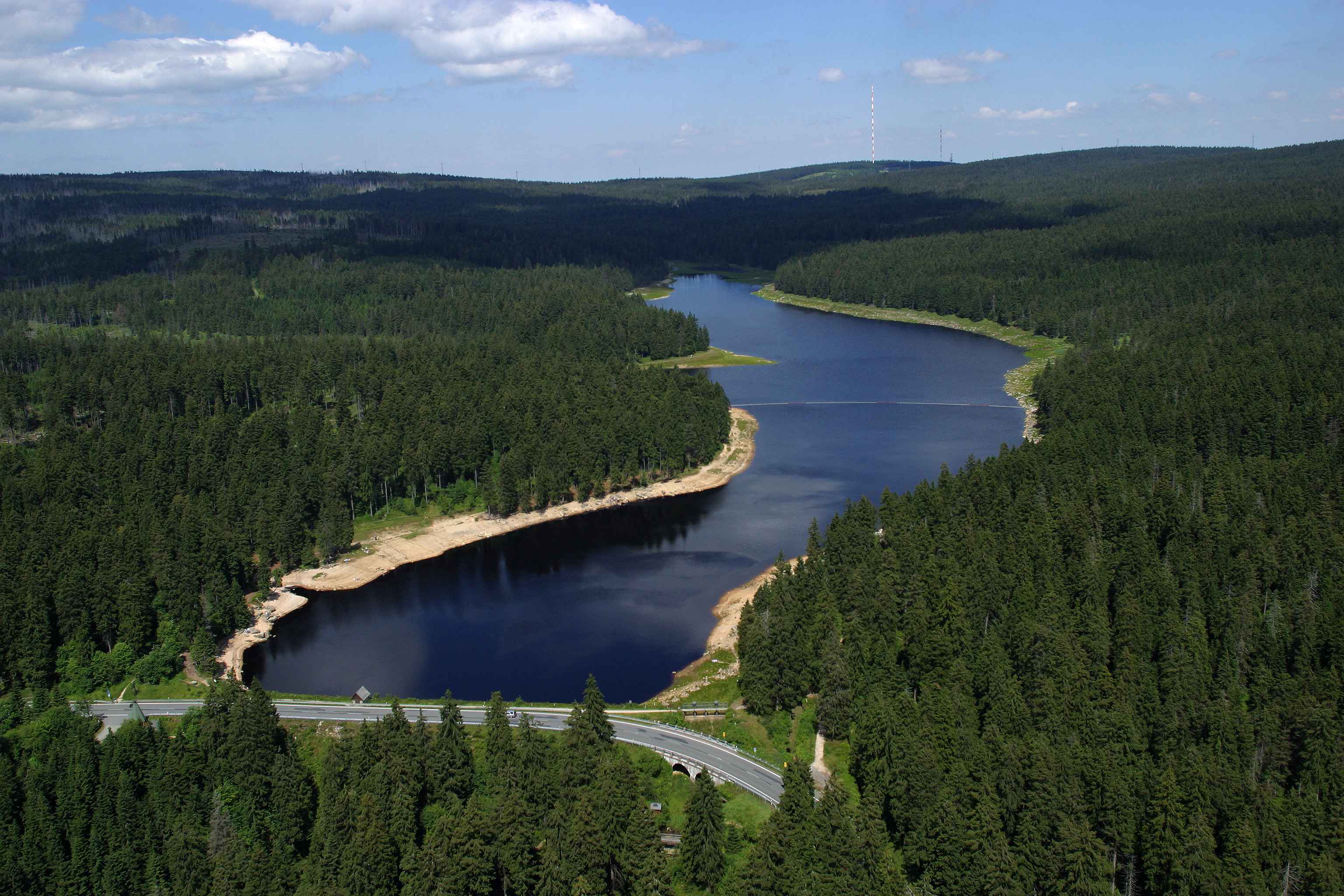
Deutsch: Luftbild des Oderteiches von Süden aus gesehen mit dem Dammbauwerk im Vordergrund. English: Aerial photograph of the Oderteich from the south. The dam structure is below the federal highway in the foreground. Harz mountains, Lower Saxony, Germany |
| Date | |
| Source | JuTe CLZ |
| Author | JuTe CLZ |
| Object location | | View this and other nearby images on: OpenStreetMap |
|---|
Licensing
| I, the copyright holder of this work, release this work into the public domain. This applies worldwide. In some countries this may not be legally possible; if so: I grant anyone the right to use this work for any purpose, without any conditions, unless such conditions are required by law. |
Original upload log
The original description page was here. All following user names refer to de.wikipedia.
- 2008-09-30 20:35 JuTe CLZ 3072×2048× (549131 bytes) {{Information |Beschreibung = Luftbild des Oderteiches von Süden aus gesehen mit dem Dammbauwerk im Vordergrund. |Quelle = |Urheber = JuTe CLZ |Datum = 30.07.2004 |Genehmigung = |Andere Versionen = |Anmerkungen = }}
File history
Click on a date/time to view the file as it appeared at that time.
| Date/Time | Thumbnail | Dimensions | User | Comment | |
|---|---|---|---|---|---|
| current | 13:18, 15 November 2009 | | 3,072 × 2,048 (536 KB) | Bermicourt | {{Information |Description={{de|Luftbild des Oderteiches von Süden aus gesehen mit dem Dammbauwerk im Vordergrund.}}{{en|Aerial photograph of the Oderteich from the south. The dam structure is below the federal highway in the foreground. Harz mountains, |
File usage
The following pages on the English Wikipedia use this file (pages on other projects are not listed):
Global file usage
The following other wikis use this file:
- Usage on de.wikipedia.org
- Usage on de.wikivoyage.org
- Usage on nl.wikipedia.org
- Usage on www.wikidata.org