No higher resolution available.
OHMap-doton-Loveland.png (274 × 300 pixels, file size: 10 KB, MIME type: image/png)
| This is a file from the Wikimedia Commons. Information from its description page there is shown below. Commons is a freely licensed media file repository. You can help. |
Summary
| Description | |
| Date | 19 July 2004 (original upload date) |
| Source |
Adapted from Wikipedia's OH county maps by Catbar. abr/> Transferred from en.wikipedia. |
| Author | Catbar at en.wikipedia |
Licensing
Catbar at en.wikipedia, the copyright holder of this work, hereby publishes it under the following license:

|
Permission is granted to copy, distribute and/or modify this document under the terms of the GNU Free Documentation License, Version 1.2 or any later version published by the Free Software Foundation; with no Invariant Sections, no Front-Cover Texts, and no Back-Cover Texts. A copy of the license is included in the section entitled GNU Free Documentation License. |
| This file is licensed under the Creative Commons Attribution-Share Alike 3.0 Unported license. | ||
| Attribution: Catbar at en.wikipedia | ||
| ||
| This licensing tag was added to this file as part of the GFDL licensing update. |
Original upload log
The original description page was here. All following user names refer to en.wikipedia.
- 2004-07-19 22:24 Catbar 274×300× (10438 bytes) {{msg:GFDL}}<br>Adapted from Wikipedia's OH county maps by Catbar.
File history
Click on a date/time to view the file as it appeared at that time.
| Date/Time | Thumbnail | Dimensions | User | Comment | |
|---|---|---|---|---|---|
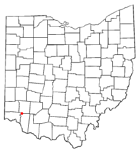
| current | 11:22, 30 January 2006 | | 274 × 300 (10 KB) | Mxn | County map of Ohio, with a red dot at '''Loveland, Ohio''', which is located in three counties. Adapted from Wikipedia's OH county maps by Catbar. {{GFDL-user|Catbar|en}} Category:Maps of Ohio |
File usage
The following pages on the English Wikipedia use this file (pages on other projects are not listed):
Global file usage
The following other wikis use this file:
- Usage on ca.wikipedia.org
- Usage on fr.wikipedia.org
- Usage on ht.wikipedia.org
- Usage on id.wikipedia.org
- Usage on it.wikipedia.org
- Usage on ja.wikipedia.org
- Usage on pl.wikipedia.org
- Usage on ru.wikipedia.org
- Usage on sh.wikipedia.org
- Usage on sr.wikipedia.org
- Usage on uk.wikipedia.org
- Usage on zh.wikipedia.org