
Size of this preview: 800 × 590 pixels. Other resolutions: 320 × 236 pixels | 640 × 472 pixels | 1,024 × 755 pixels | 1,280 × 944 pixels | 2,328 × 1,716 pixels.
Original file (2,328 × 1,716 pixels, file size: 3.39 MB, MIME type: image/jpeg)
| This is a file from the Wikimedia Commons. Information from its description page there is shown below. Commons is a freely licensed media file repository. You can help. |
Summary
| Description |
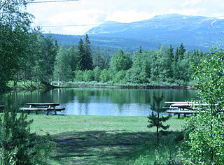
English: Tjønna Place to swim
Norsk bokmål: Badeplassen Tjønna i Nybergsund |
| Date | |
| Source | Own work |
| Author | Alvbovo |
| Camera location | | View this and other nearby images on: OpenStreetMap |
|---|
Licensing
| I, the copyright holder of this work, release this work into the public domain. This applies worldwide. In some countries this may not be legally possible; if so: I grant anyone the right to use this work for any purpose, without any conditions, unless such conditions are required by law. |
File history
Click on a date/time to view the file as it appeared at that time.
| Date/Time | Thumbnail | Dimensions | User | Comment | |
|---|---|---|---|---|---|
| current | 19:50, 15 June 2008 | | 2,328 × 1,716 (3.39 MB) | Alvbovo~commonswiki | {{Information |Description={{en|1=Tjønna Place to swim}} {{no|1=Badeplassen Tjønna i Nybergsund}} |Source=Opplasters eget arbeid (uploader's own work) |Author=Alvbovo |Date=14.06.2008 |Permission= |other_versions= }} {{location dec|61.2 |
File usage
The following pages on the English Wikipedia use this file (pages on other projects are not listed):
Global file usage
The following other wikis use this file:
- Usage on ceb.wikipedia.org
- Usage on ms.wikipedia.org
- Usage on nn.wikipedia.org
- Usage on no.wikipedia.org
- Usage on ro.wikipedia.org
- Usage on www.wikidata.org