No higher resolution available.
Numbered_map_of_Adjuntas_wards.png (545 × 484 pixels, file size: 8 KB, MIME type: image/png)
| This is a file from the Wikimedia Commons. Information from its description page there is shown below. Commons is a freely licensed media file repository. You can help. |
| Description |
|
||
| Date | |||
| Source | own work (based on http://areciboweb.50megs.com) | ||
| Author | Alessandro Cai (OliverZena) | ||
| Permission (Reusing this file) |
|
File history
Click on a date/time to view the file as it appeared at that time.
| Date/Time | Thumbnail | Dimensions | User | Comment | |
|---|---|---|---|---|---|
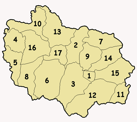
| current | 17:32, 14 March 2007 | | 545 × 484 (8 KB) | OliverZena | {{Information| |Description=*{{en}} Numbered '''wards map''' (alphabetical order) of the municipality-island of '''Adjuntas''', Puerto Rico. *{{es}} Mapa numerado (orden alfabético) de los barrios del municipio de '''Adjuntas''', Puerto Rico. *{{ |
File usage
No pages on the English Wikipedia use this file (pages on other projects are not listed).
Global file usage
The following other wikis use this file:
- Usage on it.wikipedia.org
- Usage on zh.wikipedia.org