No higher resolution available.
No_Mans_Land_Oklahoma.jpg (800 × 526 pixels, file size: 62 KB, MIME type: image/jpeg)
| This is a file from the Wikimedia Commons. Information from its description page there is shown below. Commons is a freely licensed media file repository. You can help. |
Summary
| Description |
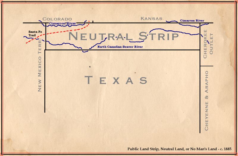
English: Map of No Man's Land (Oklahoma) - circa 1885 |
||
| Date | 8 September 2004 (original upload date) | ||
| Source | Drawn by hand by CPret. Transferred from en.wikipedia to Commons. | ||
| Author | c. 1865 | ||
| Other versions |
|


Licensing
| This file is licensed under the Creative Commons Attribution-Share Alike 3.0 Unported license. Subject to disclaimers. | ||
| ||
| This licensing tag was added to this file as part of the GFDL licensing update. |

|
Permission is granted to copy, distribute and/or modify this document under the terms of the GNU Free Documentation License, Version 1.2 or any later version published by the Free Software Foundation; with no Invariant Sections, no Front-Cover Texts, and no Back-Cover Texts. A copy of the license is included in the section entitled GNU Free Documentation License. Subject to disclaimers. |
Original upload log
The original description page was here. All following user names refer to en.wikipedia.
- 2004-09-08 00:08 CPret 800×526×8 (63320 bytes) Map of No Man's Land (Oklahoma) - circa 1885
File history
Click on a date/time to view the file as it appeared at that time.
| Date/Time | Thumbnail | Dimensions | User | Comment | |
|---|---|---|---|---|---|
| current | 19:43, 17 April 2008 | | 800 × 526 (62 KB) | File Upload Bot (Magnus Manske) | {{BotMoveToCommons|en.wikipedia}} {{Information |Description={{en|Map of No Man's Land (Oklahoma) - circa 1885 '''Source:''' Drawn by hand — CPret 00:10, 8 Sep 2004 (UTC)<br> '''Area:''' 800x526 pix<br> '''Size:''' 58.38 kb<br> |
File usage
No pages on the English Wikipedia use this file (pages on other projects are not listed).
Global file usage
The following other wikis use this file:
- Usage on br.wikipedia.org