Size of this preview: 800 × 526 pixels. Other resolutions: 320 × 210 pixels | 640 × 421 pixels | 1,024 × 673 pixels | 1,280 × 841 pixels | 2,560 × 1,682 pixels | 7,408 × 4,868 pixels.
Original file (7,408 × 4,868 pixels, file size: 9.64 MB, MIME type: image/jpeg)
| This is a file from the Wikimedia Commons. Information from its description page there is shown below. Commons is a freely licensed media file repository. You can help. |
Summary
| Description |
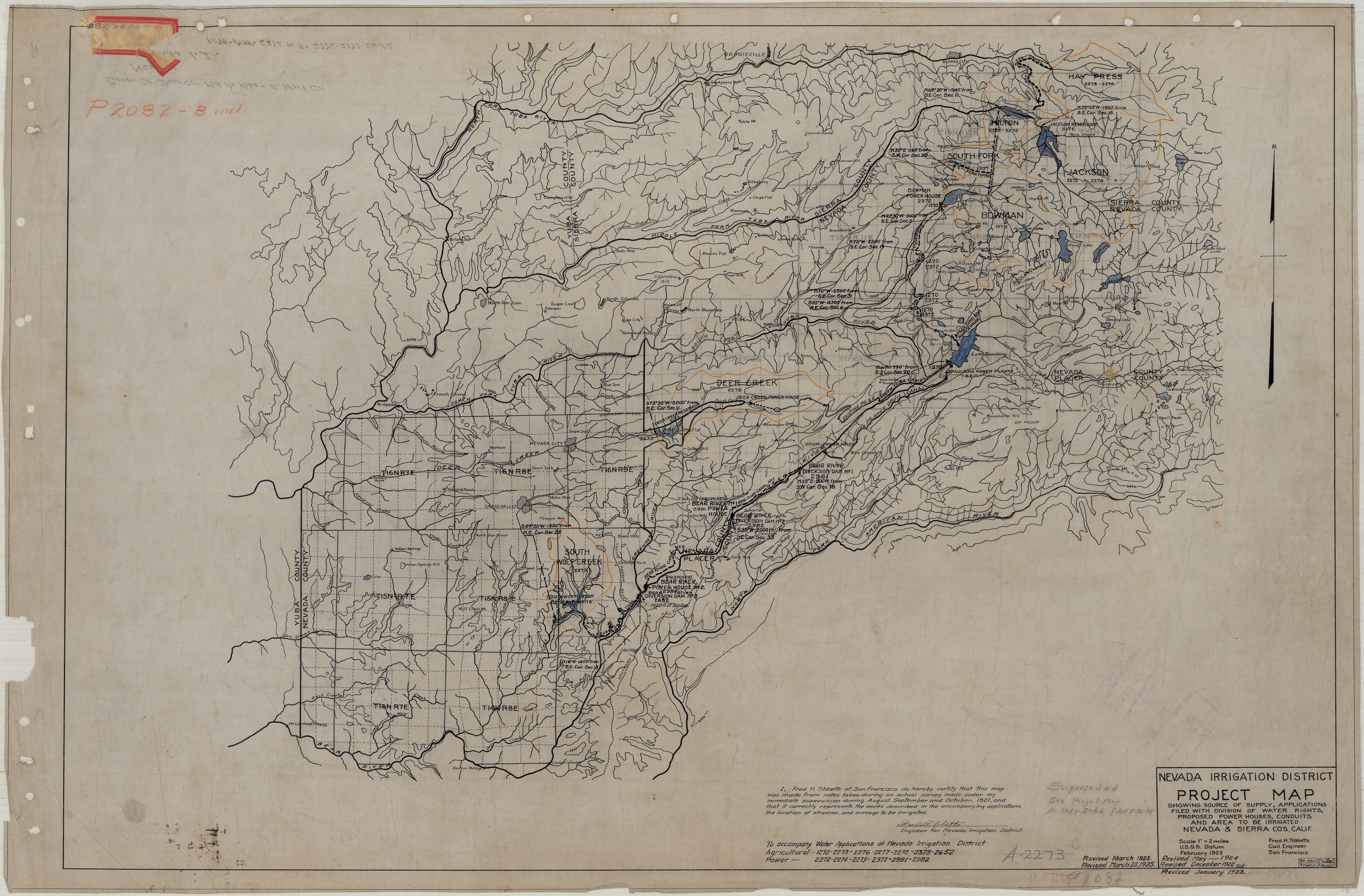
English: Nevada Irrigation District Project Map Showing Source of Supply, Applications Filed with Division of Water Rights, Proposed Power Houses, Conduits, and Area to be Irrigated. |
| Date | 02/1922 |
| Source | https://archive.org/details/map1985103001 |
| Author | Tibbetts, Fred. H. |
Licensing
This work is in the public domain in the United States because it was published (or registered with the U.S. Copyright Office) before January 1, 1929.
Public domain works must be out of copyright in both the United States and in the source country of the work in order to be hosted on the Commons. If the work is not a U.S. work, the file must have an additional copyright tag indicating the copyright status in the source country.
Note: This tag should not be used for sound recordings. |
File history
Click on a date/time to view the file as it appeared at that time.
| Date/Time | Thumbnail | Dimensions | User | Comment | |
|---|---|---|---|---|---|
| current | 23:35, 5 June 2022 | | 7,408 × 4,868 (9.64 MB) | Epolk | Uploaded a work by Tibbetts, Fred. H. from https://archive.org/details/map1985103001 with UploadWizard |
File usage
The following pages on the English Wikipedia use this file (pages on other projects are not listed):