
Size of this PNG preview of this SVG file: 773 × 543 pixels. Other resolutions: 320 × 225 pixels | 640 × 450 pixels | 1,024 × 719 pixels | 1,280 × 899 pixels | 2,560 × 1,798 pixels.
Original file (SVG file, nominally 773 × 543 pixels, file size: 721 KB)
| This is a file from the Wikimedia Commons. Information from its description page there is shown below. Commons is a freely licensed media file repository. You can help. |
Summary
| Description |
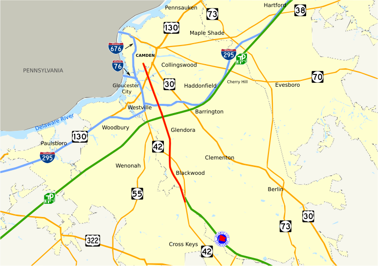
English: Map of New Jersey Route 168. |
| Date | |
| Source | Own work |
| Author | JohnnyAlbert10 |
Licensing
| I, the copyright holder of this work, release this work into the public domain. This applies worldwide. In some countries this may not be legally possible; if so: I grant anyone the right to use this work for any purpose, without any conditions, unless such conditions are required by law. |
File history
Click on a date/time to view the file as it appeared at that time.
| Date/Time | Thumbnail | Dimensions | User | Comment | |
|---|---|---|---|---|---|
| current | 12:19, 29 June 2014 | | 773 × 543 (721 KB) | Mr. Matté | Fix "Haddonfield," Route 38, and US 322 labels |
| 06:54, 18 August 2009 |  | 773 × 543 (738 KB) | JohnnyAlbert10~commonswiki | fixed bg color | |
| 05:34, 15 August 2009 |  | 773 × 543 (735 KB) | JohnnyAlbert10~commonswiki | Adjusted small text | |
| 05:24, 15 August 2009 |  | 773 × 543 (731 KB) | JohnnyAlbert10~commonswiki | {{Information |Description={{en|1=Map of New Jersey Route 168.}} |Source=Own work by uploader |Author=JohnnyAlbert10 |Date=2009-08-15 |Permission= |other_versions= }} Category:Road maps of New Jersey |
File usage
No pages on the English Wikipedia use this file (pages on other projects are not listed).
Global file usage
The following other wikis use this file:
- Usage on www.wikidata.org