No higher resolution available.
Municipalities_in_GRZ.png (299 × 299 pixels, file size: 7 KB, MIME type: image/png)
| This is a file from the Wikimedia Commons. Information from its description page there is shown below. Commons is a freely licensed media file repository. You can help. |
| Description |
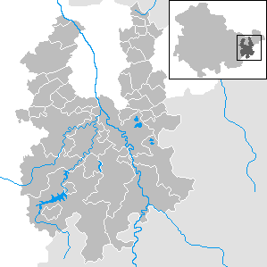
English: Municipalities in District Greiz, Thuringia Deutsch: Gemeinden im Landkreis Greiz, Thüringen |
||||||||
| Date | |||||||||
| Source | Own work | ||||||||
| Author | Rauenstein | ||||||||
| Permission (Reusing this file) |
|

File history
Click on a date/time to view the file as it appeared at that time.
| Date/Time | Thumbnail | Dimensions | User | Comment | |
|---|---|---|---|---|---|
| current | 18:46, 31 December 2023 | | 299 × 299 (7 KB) | NordNordWest | upd |
| 11:04, 31 December 2022 |  | 299 × 299 (7 KB) | NordNordWest | upd | |
| 10:51, 30 December 2019 |  | 299 × 299 (8 KB) | NordNordWest | upd | |
| 12:55, 3 March 2014 |  | 299 × 299 (8 KB) | NordNordWest | corr | |
| 17:13, 30 December 2013 |  | 299 × 299 (8 KB) | NordNordWest | upd | |
| 16:33, 20 January 2013 |  | 299 × 299 (6 KB) | NordNordWest | corr | |
| 19:52, 5 January 2013 |  | 299 × 299 (6 KB) | NordNordWest | ||
| 15:23, 25 December 2011 |  | 299 × 299 (12 KB) | Rauenstein | ||
| 06:43, 7 July 2010 |  | 299 × 299 (5 KB) | Hagar66 | {{Information |Description= {{DeLocMaps |mun= |munlink= |lk=Landkreis Greiz |enlk=District of Greiz |enlklink=Greiz (district) |frlk=L'arrondissement de Greiz |frlklink=Arrondissement de Greiz |land=Thüringen |frland=Thuringe |enland=Thuringia }} |Source |
File usage
The following pages on the English Wikipedia use this file (pages on other projects are not listed):
Global file usage
The following other wikis use this file:
- Usage on de.wikipedia.org
- Usage on uk.wikipedia.org