
Size of this preview: 758 × 600 pixels. Other resolutions: 303 × 240 pixels | 607 × 480 pixels | 970 × 768 pixels | 1,280 × 1,013 pixels | 2,560 × 2,026 pixels | 4,691 × 3,713 pixels.
Original file (4,691 × 3,713 pixels, file size: 2.68 MB, MIME type: image/jpeg)
| This is a file from the Wikimedia Commons. Information from its description page there is shown below. Commons is a freely licensed media file repository. You can help. |
|
This is an image of a place or building that is listed on the National Register of Historic Places in the United States of America. Its reference number is 75001883. |
| Description |
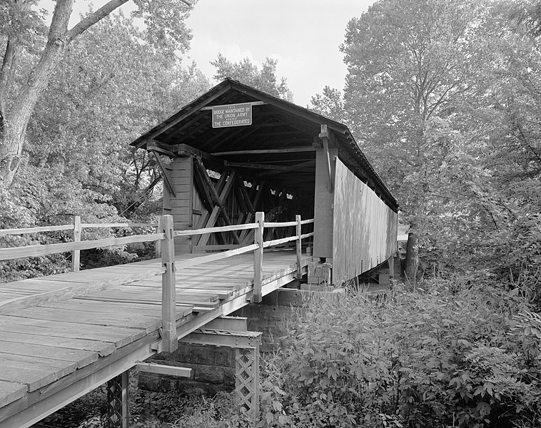
English: Northern side of the Mud River Covered Bridge, spanning the Mud River near Milton in Cabell County, West Virginia, United States. Built in 1875, the bridge was added to the National Register of Historic Places on 10 June 1975. |
||||
| Date | |||||
| Source |
Historic American Engineering Record; Library of Congress HAER WVA,6-MILT,1-1
|
||||
| Author | William Edmund Barrett | ||||
| Permission (Reusing this file) |
|

| Camera location | | View this and other nearby images on: OpenStreetMap |
|---|
File history
Click on a date/time to view the file as it appeared at that time.
| Date/Time | Thumbnail | Dimensions | User | Comment | |
|---|---|---|---|---|---|
| current | 21:41, 25 March 2009 | | 4,691 × 3,713 (2.68 MB) | Martin H. | High res; cropped |
| 14:07, 23 March 2009 |  | 1,024 × 816 (204 KB) | Nyttend | {{Location|38|25|51|N|82|8|22|W}} {{Information |Description={{en|Northern side of the {{w|Mud River Covered Bridge}}, spanning the {{w|Mud River (West Virginia)|Mud River}} near {{w|Milton, West Virginia|Milton}} in {{w|Cabell County, West Virginia|Cabel |
File usage
The following pages on the English Wikipedia use this file (pages on other projects are not listed):
Global file usage
The following other wikis use this file:
- Usage on www.wikidata.org