
Size of this preview: 577 × 599 pixels. Other resolutions: 231 × 240 pixels | 462 × 480 pixels | 740 × 768 pixels | 986 × 1,024 pixels | 1,973 × 2,048 pixels | 3,461 × 3,593 pixels.
Original file (3,461 × 3,593 pixels, file size: 2.08 MB, MIME type: image/jpeg)
| This is a file from the Wikimedia Commons. Information from its description page there is shown below. Commons is a freely licensed media file repository. You can help. |
Summary
| Description |
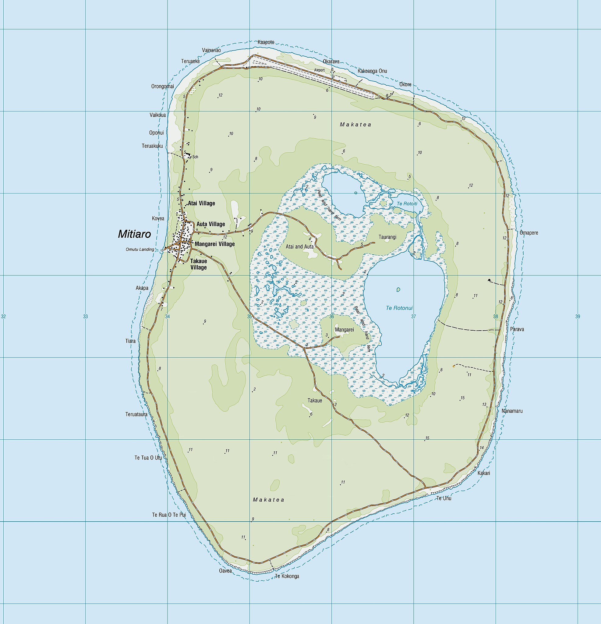
English: topographic map of Mitiaro Island, southern Cook Islands, South Pacific Ocean |
| Date | |
| Source | https://www.linz.govt.nz/land/maps/pacific-region-maps |
| Author | Land Information New Zealand |
| Other versions |

.jpg)
.jpg&action=edit&redlink=1)
.jpg)
Licensing
This file is licensed under the Creative Commons Attribution 4.0 International license.
- You are free:
- to share – to copy, distribute and transmit the work
- to remix – to adapt the work
- Under the following conditions:
- attribution – You must give appropriate credit, provide a link to the license, and indicate if changes were made. You may do so in any reasonable manner, but not in any way that suggests the licensor endorses you or your use.
File history
Click on a date/time to view the file as it appeared at that time.
| Date/Time | Thumbnail | Dimensions | User | Comment | |
|---|---|---|---|---|---|
| current | 14:36, 6 January 2022 | | 3,461 × 3,593 (2.08 MB) | Skimel | File:Mitiaro Island topo map 2014.jpg cropped 63 % horizontally, 71 % vertically using CropTool with precise mode. |
File usage
The following pages on the English Wikipedia use this file (pages on other projects are not listed):
Global file usage
The following other wikis use this file:
- Usage on fr.wikipedia.org
.jpg)