No higher resolution available.
Mekkhala_2015_landfall.gif (720 × 480 pixels, file size: 2.51 MB, MIME type: image/gif, looped, 15 frames, 3.1 s)
| This is a file from the Wikimedia Commons. Information from its description page there is shown below. Commons is a freely licensed media file repository. You can help. |
Summary
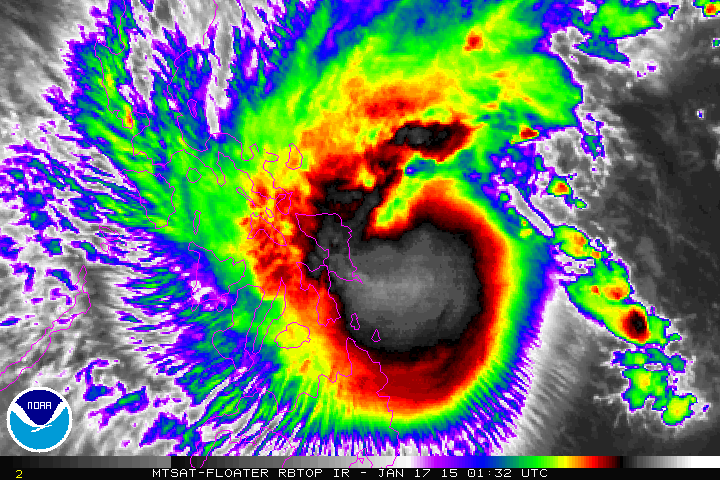
| Description |
English: The enhanced infrared satellite loop presents Severe Tropical Storm Mekkhala from 01:32 UTC to 08:32 UTC on January 17, 2015, which made landfall over Dolores, Eastern Samar at around 15:00 Philippine Standard Time (07:00 UTC). |
| Date | |
| Source | http://www.ssd.noaa.gov/PS/TROP/floaters/ |
| Author | National Oceanic and Atmospheric Administration Satellite Services Division |
Licensing
This image is in the public domain because it contains materials that originally came from the U.S. National Oceanic and Atmospheric Administration, taken or made as part of an employee's official duties.
|
File history
Click on a date/time to view the file as it appeared at that time.
| Date/Time | Thumbnail | Dimensions | User | Comment | |
|---|---|---|---|---|---|
| current | 09:49, 17 January 2015 | | 720 × 480 (2.51 MB) | Meow | User created page with UploadWizard |
File usage
The following pages on the English Wikipedia use this file (pages on other projects are not listed):
Global file usage
The following other wikis use this file:
- Usage on de.wikipedia.org
- Usage on es.wikipedia.org
- Usage on vi.wikipedia.org
- Usage on zh.wikipedia.org