File:Marylebone Map Clipping from Neuester Grundriss von London Westminster und Southwark 1770.jpg
Size of this preview: 600 × 599 pixels. Other resolutions: 240 × 240 pixels | 481 × 480 pixels | 651 × 650 pixels.
Original file (651 × 650 pixels, file size: 231 KB, MIME type: image/jpeg)
| This is a file from the Wikimedia Commons. Information from its description page there is shown below. Commons is a freely licensed media file repository. You can help. |
Summary
| Description |
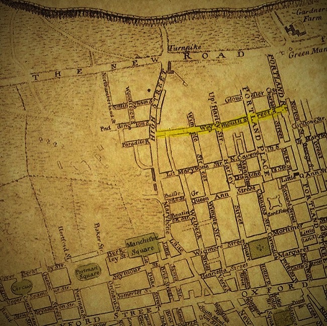
English: Clip from map of London, Westminster and Southwark drawn by Gottlob Liebe showing Marylebone in circa 1770. Weymouth Street (outlined yellow) had been recently laid out for development. |
| Date | |
| Source |
LinkNeuester Grundriss von London, Westminster, und Southwark Plan : Kupferdruck ; 36 x 67 cm c. 1770 |
| Author | Liebe, Gottlob August |
| Camera location | | View this and other nearby images on: OpenStreetMap |
|---|
Licensing
|
This work is in the public domain in its country of origin and other countries and areas where the copyright term is the author's life plus 70 years or fewer. This work is in the public domain in the United States because it was published (or registered with the U.S. Copyright Office) before January 1, 1929. | |
| This file has been identified as being free of known restrictions under copyright law, including all related and neighboring rights. | |
File history
Click on a date/time to view the file as it appeared at that time.
| Date/Time | Thumbnail | Dimensions | User | Comment | |
|---|---|---|---|---|---|
| current | 09:28, 5 October 2016 | | 651 × 650 (231 KB) | Mboner45 | User created page with UploadWizard |
File usage
The following pages on the English Wikipedia use this file (pages on other projects are not listed):