Size of this preview: 620 × 599 pixels. Other resolutions: 248 × 240 pixels | 496 × 480 pixels | 794 × 768 pixels | 1,059 × 1,024 pixels | 1,600 × 1,547 pixels.
Original file (1,600 × 1,547 pixels, file size: 198 KB, MIME type: image/png)
| This is a file from the Wikimedia Commons. Information from its description page there is shown below. Commons is a freely licensed media file repository. You can help. |

|
This transport map image could be re-created using vector graphics as an SVG file. This has several advantages; see Commons:Media for cleanup for more information. If an SVG form of this image is available, please upload it and afterwards replace this template with
{{vector version available|new image name}}.
It is recommended to name the SVG file “Marseille - Metro - Netzplan.svg”—then the template Vector version available (or Vva) does not need the new image name parameter. |
Summary
| Description |
|
| Date | |
| Source | Own work |
| Author | Maximilian Dörrbecker (Chumwa) |
| Permission (Reusing this file) |
I, the copyright holder of this work, hereby publish it under the following license: This file is licensed under the Creative Commons Attribution-Share Alike 2.5 Generic license.
Sie dürfen das Bild zu den folgenden Bedingungen nutzen:
|
| Other versions |
|


File history
Click on a date/time to view the file as it appeared at that time.
| Date/Time | Thumbnail | Dimensions | User | Comment | |
|---|---|---|---|---|---|
| current | 20:12, 17 August 2010 | | 1,600 × 1,547 (198 KB) | Chumwa | Aktualisierung 2010 |
| 07:29, 17 May 2009 |  | 1,600 × 1,547 (203 KB) | Chumwa | Schrift vergrößert | |
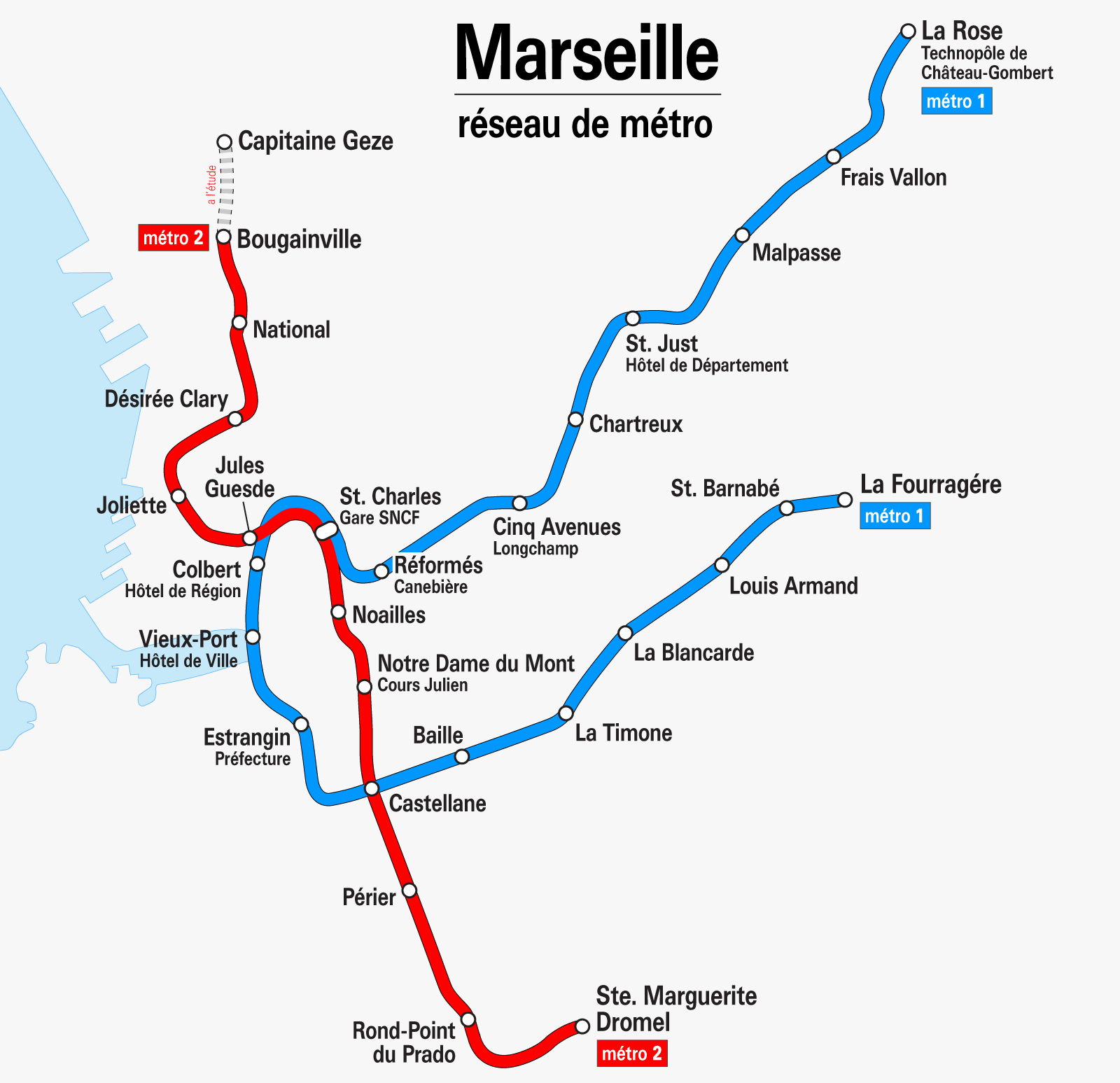
| 07:03, 17 May 2009 |  | 1,600 × 1,547 (174 KB) | Chumwa | {{Information |Description= *{{ de }} Karte: Netzplan der Metro Marseille, Stand Mai 2009 *{{ en }} Map: Marseille underground network as of May 2009 *{{ fr }} Plan: Réseau des métros de Marseille en Mai 2009 |Source=Self made |Date=May 2009 |Author= [[ |
File usage
No pages on the English Wikipedia use this file (pages on other projects are not listed).
Global file usage
The following other wikis use this file:
- Usage on be.wikipedia.org
- Usage on bn.wikipedia.org
- Usage on ca.wikipedia.org
- Usage on de.wikivoyage.org
- Usage on es.wikipedia.org
- Usage on eu.wikipedia.org
- Usage on fa.wikipedia.org
- Usage on fi.wikipedia.org
- Usage on hu.wikipedia.org
- Usage on id.wikipedia.org
- Usage on ja.wikipedia.org
- Usage on ka.wikipedia.org
- Usage on ko.wikipedia.org
- Usage on nl.wikipedia.org
- Usage on pl.wikipedia.org
- Usage on pl.wikivoyage.org
- Usage on pt.wikipedia.org
- Usage on ru.wikipedia.org
- Usage on th.wikipedia.org
- Usage on www.wikidata.org