Size of this preview: 686 × 599 pixels. Other resolutions: 275 × 240 pixels | 549 × 480 pixels | 879 × 768 pixels | 1,172 × 1,024 pixels | 1,702 × 1,487 pixels.
Original file (1,702 × 1,487 pixels, file size: 220 KB, MIME type: image/jpeg)
| This is a file from the Wikimedia Commons. Information from its description page there is shown below. Commons is a freely licensed media file repository. You can help. |
Summary
| Description |
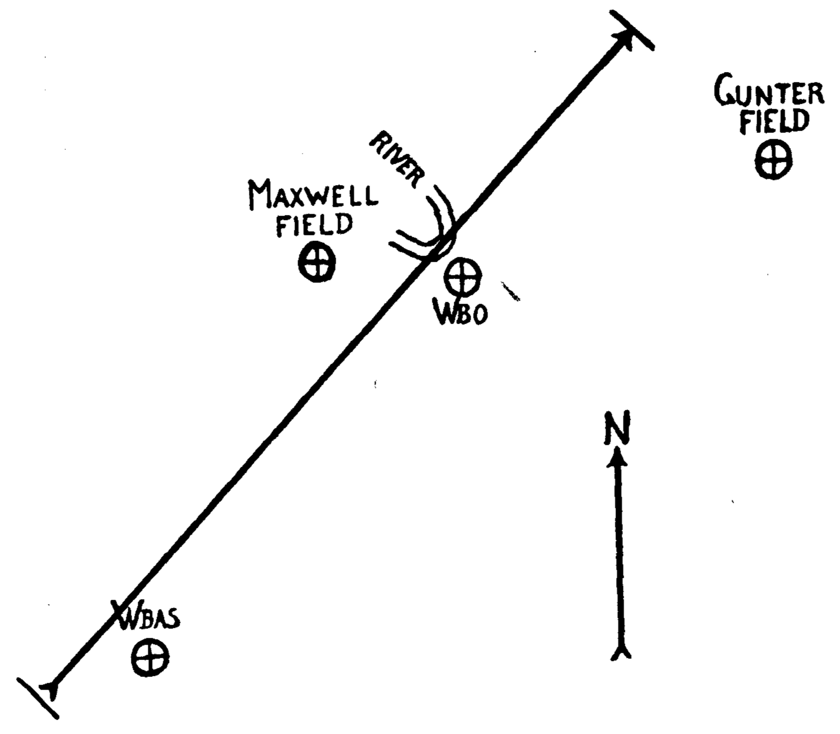
English: A map of the February 12, 1945 Montgomery, Alabama tornado.
Legend: WBAS: U.S. Weather Bureau Airport Station WBO: U.S. Weather Bureau Office |
| Date | |
| Source | https://www.jstor.org/stable/26257954 |
| Author | F. C. Pate (U.S. Weather Bureau, Montgomery, Alabama) |
Licensing
This image is in the public domain because it contains materials that originally came from the U.S. National Oceanic and Atmospheric Administration, taken or made as part of an employee's official duties.
|
File history
Click on a date/time to view the file as it appeared at that time.
| Date/Time | Thumbnail | Dimensions | User | Comment | |
|---|---|---|---|---|---|
| current | 05:01, 28 May 2023 | | 1,702 × 1,487 (220 KB) | WeatherWriter | Uploaded a work by F. C. Pate (U.S. Weather Bureau, Montgomery, Alabama) from https://www.jstor.org/stable/26257954 with UploadWizard |
File usage
The following pages on the English Wikipedia use this file (pages on other projects are not listed):