,_its_railway_reserves,_and_Solomontown,_1896.jpg)
,_its_railway_reserves,_and_Solomontown,_1896.jpg&action=edit&redlink=1)

Size of this preview: 800 × 566 pixels. Other resolutions: 320 × 226 pixels | 640 × 453 pixels | 1,024 × 724 pixels | 1,280 × 905 pixels | 2,560 × 1,810 pixels | 3,507 × 2,480 pixels.
Original file (3,507 × 2,480 pixels, file size: 4.64 MB, MIME type: image/jpeg)
| This is a file from the Wikimedia Commons. Information from its description page there is shown below. Commons is a freely licensed media file repository. You can help. |
,_its_railway_reserves,_and_Solomontown,_1896.jpg)
Summary
| Description |
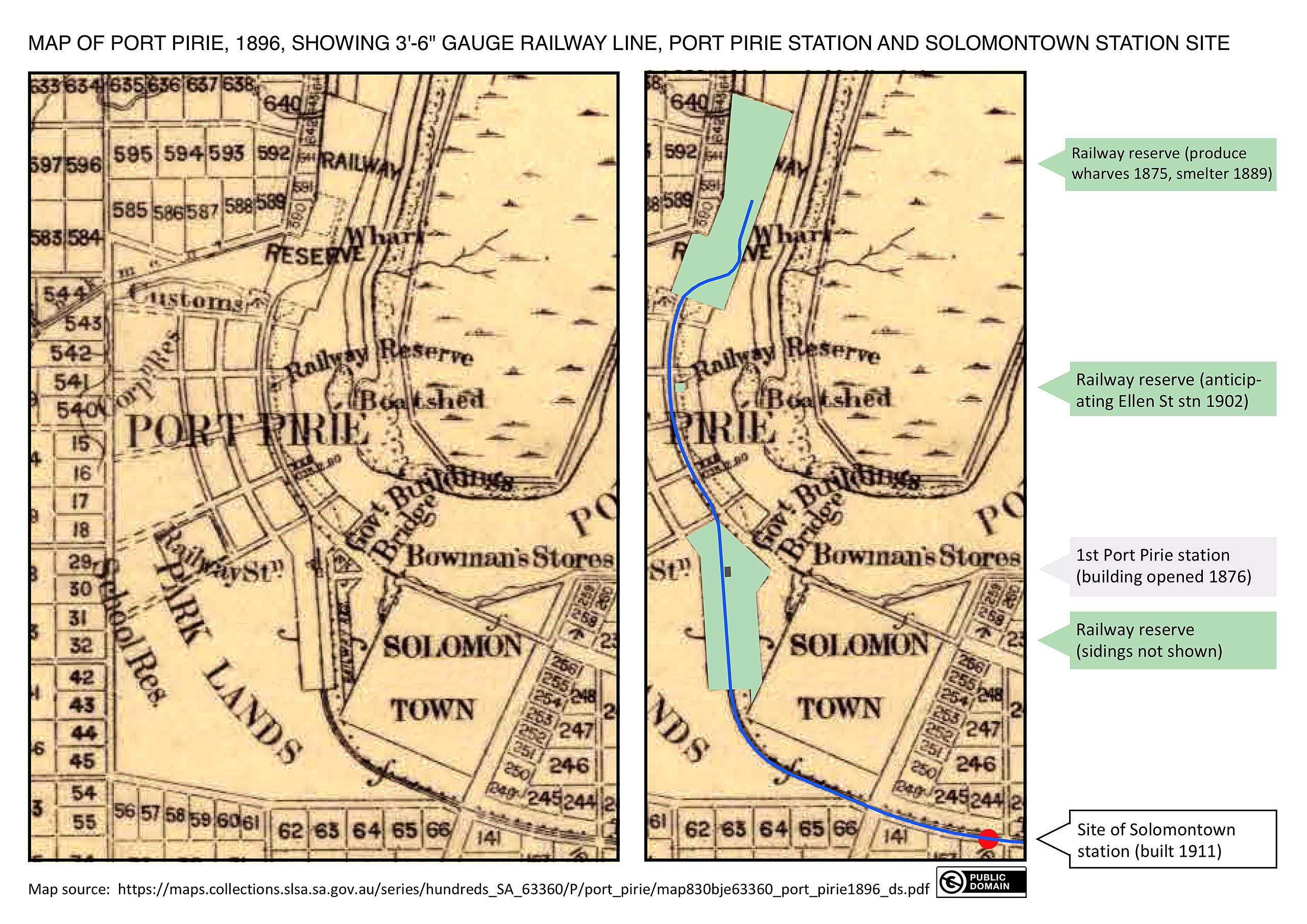
English: Map of Port Pirie, South Australia (part), its railway reserves, and Solomontown, 1896. To the right of the original map is a copy overlaid with explanatory artwork. |
| Date | |
| Source |
Map: State Library of South Australia – https://maps.collections.slsa.sa.gov.au/series/hundreds_SA_63360/P/port_pirie/map830bje63360_port_pirie1896_ds.pdf Other artwork: SCHolar44 (CC0 public domain declaration) |
| Author | South Australian Surveyor-General's Office |
| Other versions | The complete map from which this segment was taken is Map of the hundred of Pirie, 1896 |
.png)
| Camera location | | View this and other nearby images on: OpenStreetMap |
|---|
,_its_railway_reserves,_and_Solomontown,_1896.jpg¶ms=-33.180000_N_0138.010000_E_globe:Earth_type:camera__&language=en)
Licensing
This file is in the public domain because the following criteria are satisfied:
|
File history
Click on a date/time to view the file as it appeared at that time.
| Date/Time | Thumbnail | Dimensions | User | Comment | |
|---|---|---|---|---|---|
| current | 12:56, 12 March 2020 | | 3,507 × 2,480 (4.64 MB) | SCHolar44 | Uploaded a work by South Australian Surveyor-General's Office from Map: State Library of South Australia – https://maps.collections.slsa.sa.gov.au/series/hundreds_SA_63360/P/port_pirie/map830bje63360_port_pirie1896_ds.pdf Other artwork: SCHolar44 (CC0 public domain declaration) with UploadWizard |
File usage
The following pages on the English Wikipedia use this file (pages on other projects are not listed):
,_its_railway_reserves,_and_Solomontown,_1896.jpg)