Size of this preview: 295 × 598 pixels. Other resolutions: 118 × 240 pixels | 431 × 874 pixels.
Original file (431 × 874 pixels, file size: 33 KB, MIME type: image/png)
| This is a file from the Wikimedia Commons. Information from its description page there is shown below. Commons is a freely licensed media file repository. You can help. |
| Description |
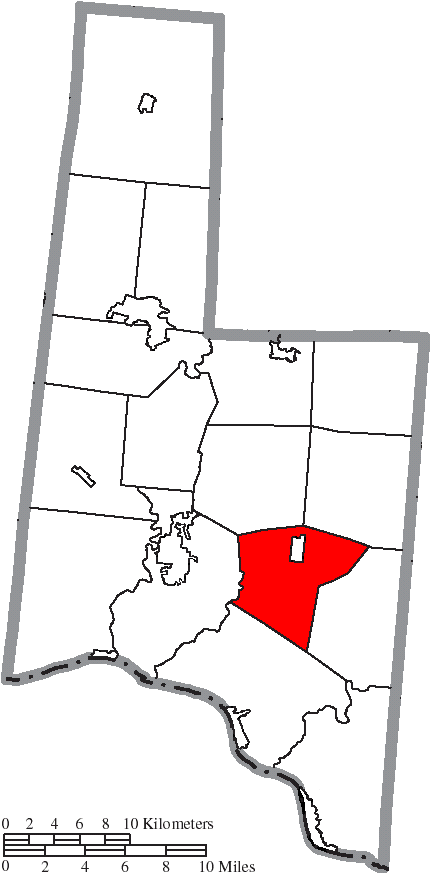
English: Map of the municipal and township boundaries of Brown County, Ohio, United States, as of the 2000 census, with the location of Jefferson Township highlighted. Township borders are shown only in unincorporated areas in order to differentiate incorporated and unincorporated areas more clearly. |
| Date | |
| Source | File:Map of Brown County Ohio With Municipal and Township Labels.PNG |
| Author | Ruhrfisch and Nyttend |
| Permission (Reusing this file) |
This file is licensed under the Creative Commons Attribution-Share Alike 3.0 Unported license.
|
File history
Click on a date/time to view the file as it appeared at that time.
| Date/Time | Thumbnail | Dimensions | User | Comment | |
|---|---|---|---|---|---|
| current | 21:03, 15 August 2015 | | 431 × 874 (33 KB) | Nyttend | {{Information |Description={{en|Map of the municipal and township boundaries of {{w|Brown County, Ohio|Brown County}}, {{w|Ohio}}, {{w|United States}}, as of the 2000 census, with the location of {{w|Jefferson Township, Brown County, Ohio|Jefferson Tow... |
File usage
The following pages on the English Wikipedia use this file (pages on other projects are not listed):
Global file usage
The following other wikis use this file:
- Usage on eu.wikipedia.org
- Usage on fa.wikipedia.org
- Usage on pt.wikipedia.org
- Usage on www.wikidata.org
- Usage on zh.wikipedia.org