Size of this preview: 559 × 600 pixels. Other resolutions: 224 × 240 pixels | 447 × 480 pixels | 1,000 × 1,073 pixels.
Original file (1,000 × 1,073 pixels, file size: 130 KB, MIME type: image/jpeg)
| This is a file from the Wikimedia Commons. Information from its description page there is shown below. Commons is a freely licensed media file repository. You can help. |
Summary
| Description |
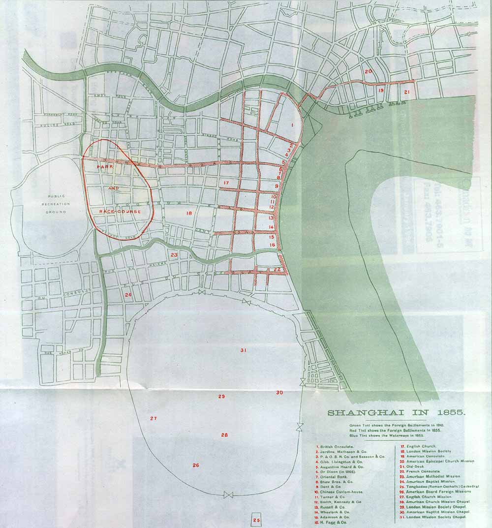
English: A map of Shanghai's foreign concessions in 1855 (in red), overlaid (in green) with the contemporary street pattern in 1910 http://www.earnshaw.com/shanghai-ed-india/tales/t-map.htm |
| Date | 23 January 2010 (original upload date) |
| Source | www.earnshaw.com |
| Creator |
Unknown author |
| Georeferencing | If inappropriate please set warp_status = skip to hide. |
Licensing
|
This work is in the public domain in its country of origin and other countries and areas where the copyright term is the author's life plus 100 years or fewer. | |
| This file has been identified as being free of known restrictions under copyright law, including all related and neighboring rights. | |
Original upload log
Transferred from en.wikipedia to Commons using For the Common Good.
The original description page was here. All following user names refer to en.wikipedia.
| Date/Time | Dimensions | User | Comment |
|---|---|---|---|
| 16:27, 23 January 2010 | 1,000 × 1,073 (133,344 bytes) | w:en:Smjwalsh (talk | contribs) | http://www.earnshaw.com/shanghai-ed-india/tales/t-map.htm |
File history
Click on a date/time to view the file as it appeared at that time.
| Date/Time | Thumbnail | Dimensions | User | Comment | |
|---|---|---|---|---|---|
| current | 07:02, 18 May 2014 | | 1,000 × 1,073 (130 KB) | Philg88 | Transferred from en.wikipedia: see original upload log above |
File usage
The following pages on the English Wikipedia use this file (pages on other projects are not listed):
Global file usage
The following other wikis use this file:
- Usage on de.wikipedia.org
- Usage on www.wikidata.org