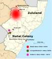
Size of this PNG preview of this SVG file: 527 × 599 pixels. Other resolutions: 211 × 240 pixels | 422 × 480 pixels | 675 × 768 pixels | 900 × 1,024 pixels | 1,801 × 2,048 pixels | 663 × 754 pixels.
Original file (SVG file, nominally 663 × 754 pixels, file size: 2.19 MB)
File history
Click on a date/time to view the file as it appeared at that time.
| Date/Time | Thumbnail | Dimensions | User | Comment | |
|---|---|---|---|---|---|
| current | 11:01, 25 November 2014 |  | 663 × 754 (2.19 MB) | Martinvl | Adjusted text so that it will fit into the frasme (hopefully) |
| 16:55, 19 November 2014 |  | 663 × 754 (2.18 MB) | Martinvl | Text correction (again!) | |
| 16:47, 19 November 2014 |  | 663 × 754 (2.19 MB) | Martinvl | Error in updating file | |
| 16:43, 19 November 2014 |  | 663 × 754 (2.19 MB) | Martinvl | Another attempt to make text "Drakensberg Mountains" visible | |
| 21:56, 13 November 2013 |  | 663 × 754 (2.19 MB) | Martinvl | Text "Drakensberg Mountains" made visible. text of "Bushmans River Pass" moved and an arrow added. | |
| 15:09, 19 July 2011 |  | 663 × 754 (2.18 MB) | Martinvl | Attempting to display the text "Dakensberg Mountains" | |
| 15:47, 18 July 2011 |  | 663 × 754 (2.18 MB) | Martinvl | Adding tribal areas | |
| 14:56, 18 July 2011 |  | 663 × 754 (2.18 MB) | Martinvl | Adding more detail | |
| 20:50, 16 July 2011 |  | 663 × 754 (2.18 MB) | Martinvl | Attempting to correct black blocks | |
| 14:36, 23 June 2011 |  | 663 × 754 (2.19 MB) | Martinvl | Text tidied up |
File usage
The following pages on the English Wikipedia use this file (pages on other projects are not listed):