
Size of this preview: 778 × 600 pixels. Other resolutions: 312 × 240 pixels | 623 × 480 pixels | 997 × 768 pixels | 1,280 × 987 pixels | 2,168 × 1,671 pixels.
Original file (2,168 × 1,671 pixels, file size: 427 KB, MIME type: image/png)
| This is a file from the Wikimedia Commons. Information from its description page there is shown below. Commons is a freely licensed media file repository. You can help. |
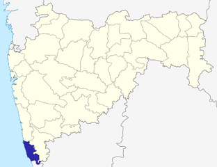
Sindhudurg dist
Source: Drawn by me
| I, the copyright holder of this work, release this work into the public domain. This applies worldwide. In some countries this may not be legally possible; if so: I grant anyone the right to use this work for any purpose, without any conditions, unless such conditions are required by law. |
\
File history
Click on a date/time to view the file as it appeared at that time.
| Date/Time | Thumbnail | Dimensions | User | Comment | |
|---|---|---|---|---|---|
| current | 06:34, 6 October 2015 | | 2,168 × 1,671 (427 KB) | Abhijitsathe | State map updated to reflect new Palghar district |
| 01:19, 22 September 2009 |  | 2,789 × 2,232 (955 KB) | Abhijitsathe | India map inset | |
| 16:10, 10 April 2009 |  | 2,789 × 2,232 (795 KB) | Abhijitsathe | Higher resolution | |
| 17:29, 6 August 2005 |  | 200 × 161 (4 KB) | Nichalp | Sindhudurg dist Source: Drawn by me {{PD-self}} Category:Maharashtra district maps\ |
File usage
No pages on the English Wikipedia use this file (pages on other projects are not listed).
Global file usage
The following other wikis use this file:
- Usage on sat.wikipedia.org