Size of this preview: 800 × 233 pixels. Other resolutions: 320 × 93 pixels | 914 × 266 pixels.
Original file (914 × 266 pixels, file size: 70 KB, MIME type: image/jpeg)
| This is a file from the Wikimedia Commons. Information from its description page there is shown below. Commons is a freely licensed media file repository. You can help. |
Summary
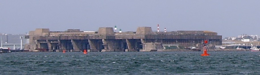
| Description | fr:Lorient en:submarine base, april 2007 |
| Date | |
| Source | Own work |
| Author | Vberger |
| Object location | | View this and other nearby images on: OpenStreetMap |
|---|
Licensing
| I, the copyright holder of this work, release this work into the public domain. This applies worldwide. In some countries this may not be legally possible; if so: I grant anyone the right to use this work for any purpose, without any conditions, unless such conditions are required by law. |
File history
Click on a date/time to view the file as it appeared at that time.
| Date/Time | Thumbnail | Dimensions | User | Comment | |
|---|---|---|---|---|---|
| current | 19:53, 22 July 2008 | 914 × 266 (70 KB) | Ian Dunster~commonswiki | Set levels. Reduced noise in sky. | |
| 12:59, 2 June 2007 | 914 × 266 (45 KB) | Vberger~commonswiki | {{Information |Description=fr:Lorient en:submarine base, april 2007 |Source=self-made |Date=april 2007 |Author= User:Vberger }} category:submarines category:lorient |
File usage
The following pages on the English Wikipedia use this file (pages on other projects are not listed):
Global file usage
The following other wikis use this file:
- Usage on ca.wikipedia.org
- Usage on da.wikipedia.org
- Usage on el.wikipedia.org
- Usage on eo.wikipedia.org
- Usage on fr.wikipedia.org
- Usage on he.wikipedia.org
- Usage on ro.wikipedia.org
- Usage on uk.wikipedia.org