No higher resolution available.
LocSpiere-Helkijn.png (270 × 203 pixels, file size: 5 KB, MIME type: image/png)
| This is a file from the Wikimedia Commons. Information from its description page there is shown below. Commons is a freely licensed media file repository. You can help. |

|
File:Spiere-Helkijn West-Flanders Belgium Map.svg is a vector version of this file. It should be used in place of this PNG file when not inferior.
File:LocSpiere-Helkijn.png → File:Spiere-Helkijn West-Flanders Belgium Map.svg
For more information, see Help:SVG. |
 |
Summary
| Description |
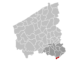
English: Map of the province West-Flanders, showing Spiere-Helkijn (Espierres-Helchin) municipality in red, and Kortrijk arrondissement in dark
Français : Carte indiquant la localisation de la commune d'Espierres-Helchin (en rouge) dans la province de Flandre occidentale, avec l'arrondissement de Courtrai en gris foncé
Nederlands: Kaart van de provincie West-Vlaanderen met de gemeente Spiere-Helkijn in het rood en het arrondissement Kortrijk in het donkergrijs. |
| Date | 11 January 2006 (original upload date) |
| Source | No machine-readable source provided. Own work assumed (based on copyright claims). |
| Author | No machine-readable author provided. Wester assumed (based on copyright claims). |
Licensing
| I, the copyright holder of this work, release this work into the public domain. This applies worldwide. In some countries this may not be legally possible; if so: I grant anyone the right to use this work for any purpose, without any conditions, unless such conditions are required by law. |
File history
Click on a date/time to view the file as it appeared at that time.
| Date/Time | Thumbnail | Dimensions | User | Comment | |
|---|---|---|---|---|---|
| current | 18:02, 11 January 2006 | | 270 × 203 (5 KB) | Wester | '''en:''' Map of the province West-Flanders, showing Spiere-Helkijn (Espierres-Helchin) municipality in red, and Kortrijk arrondissement in dark '''fr:''' Carte indiquant la localisation de la commune d'Espierres-Helchin (en rouge) dans la province de Fl |
File usage
No pages on the English Wikipedia use this file (pages on other projects are not listed).
Global file usage
The following other wikis use this file:
- Usage on eo.wikipedia.org
- Usage on et.wikipedia.org
- Usage on fa.wikipedia.org
- Usage on fy.wikipedia.org
- Usage on it.wikipedia.org
- Usage on li.wikipedia.org
- Usage on pt.wikipedia.org
- Usage on ro.wikipedia.org
- Usage on sk.wikipedia.org
- Usage on vls.wikipedia.org