No higher resolution available.
Little_Petherick_Creek_and_Sea_Mills_-_geograph.org.uk_-_721870.jpg (640 × 427 pixels, file size: 175 KB, MIME type: image/jpeg)
| This is a file from the Wikimedia Commons. Information from its description page there is shown below. Commons is a freely licensed media file repository. You can help. |
Summary
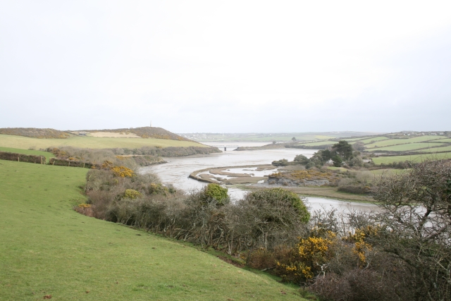
| Description |
English: Little Petherick Creek and Sea Mills. On the right of the creek is Sea Mills 721837, a former tidal mill, and in the distance, at the foot of the creek, the railway viaduct (now part of the Camel Trail). The Dennis Hill obelisk is visible to the left of centre. |
| Date | |
| Source | From geograph.org.uk |
| Author | Hugh Craddock |
| Attribution (required by the license) | Hugh Craddock / Little Petherick Creek and Sea Mills / |
| Camera location | | View this and other nearby images on: OpenStreetMap |
|---|
_heading:45.00&language=en)
| Object location | | View this and other nearby images on: OpenStreetMap |
|---|
_heading:45.00&language=en)
Licensing

|
This image was taken from the Geograph project collection. See this photograph's page on the Geograph website for the photographer's contact details. The copyright on this image is owned by Hugh Craddock and is licensed for reuse under the Creative Commons Attribution-ShareAlike 2.0 license.
|
This file is licensed under the Creative Commons Attribution-Share Alike 2.0 Generic license.
Attribution: Hugh Craddock
- You are free:
- to share – to copy, distribute and transmit the work
- to remix – to adapt the work
- Under the following conditions:
- attribution – You must give appropriate credit, provide a link to the license, and indicate if changes were made. You may do so in any reasonable manner, but not in any way that suggests the licensor endorses you or your use.
- share alike – If you remix, transform, or build upon the material, you must distribute your contributions under the same or compatible license as the original.
File history
Click on a date/time to view the file as it appeared at that time.
| Date/Time | Thumbnail | Dimensions | User | Comment | |
|---|---|---|---|---|---|
| current | 05:02, 19 February 2011 | | 640 × 427 (175 KB) | GeographBot | == {{int:filedesc}} == {{Information |description={{en|1=Little Petherick Creek and Sea Mills On the right of the creek is Sea Mills 721837, a former tidal mill, and in the distance, at the foot of the creek, the railway viaduct (now part of the Camel |
File usage
The following pages on the English Wikipedia use this file (pages on other projects are not listed):
Global file usage
The following other wikis use this file:
- Usage on eu.wikipedia.org
- Usage on www.wikidata.org