Size of this preview: 484 × 600 pixels. Other resolutions: 194 × 240 pixels | 387 × 480 pixels | 620 × 768 pixels | 826 × 1,024 pixels | 2,488 × 3,083 pixels.
Original file (2,488 × 3,083 pixels, file size: 649 KB, MIME type: image/jpeg)
| This is a file from the Wikimedia Commons. Information from its description page there is shown below. Commons is a freely licensed media file repository. You can help. |
Summary
| Description |
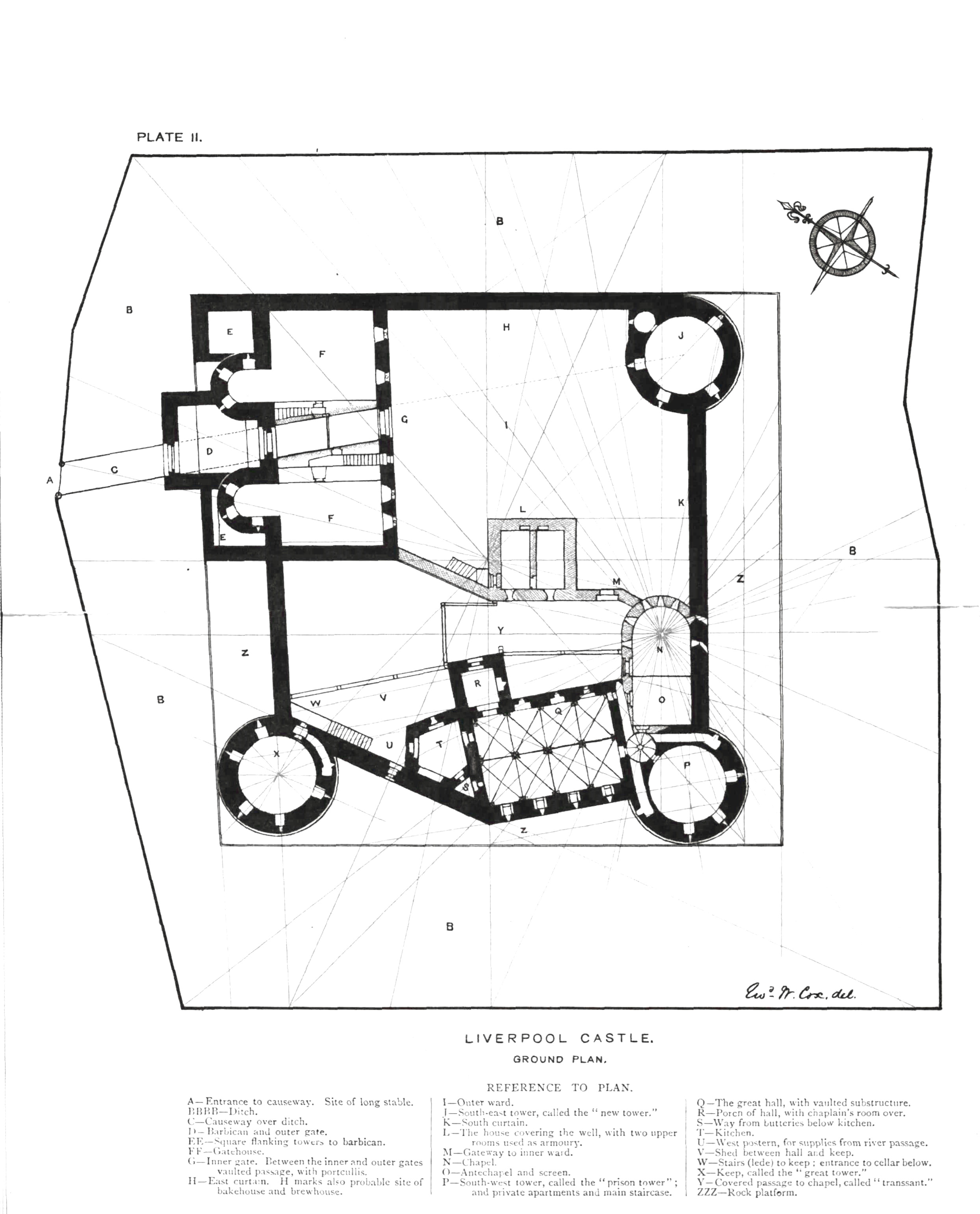
English: A plan of Liverpool Castle produced in 1892 by historian Edward Cox. The plan was created using "maps and surveys of an official character" (https://www.cantab.net/users/michael.behrend/repubs/j_geomancy/v3n4/pages/cox_liv_castle.html). Taken from the original, yellowing removed, retains legible text. |
| Date | |
| Source | Transactions of the Historical Society of Lancashire & Cheshire (1892) vol.42 |
| Author | Edward Cox |
Licensing
|
This work is in the public domain in its country of origin and other countries and areas where the copyright term is the author's life plus 70 years or fewer. This work is in the public domain in the United States because it was published (or registered with the U.S. Copyright Office) before January 1, 1929. | |
| This file has been identified as being free of known restrictions under copyright law, including all related and neighboring rights. | |
File history
Click on a date/time to view the file as it appeared at that time.
| Date/Time | Thumbnail | Dimensions | User | Comment | |
|---|---|---|---|---|---|
| current | 03:48, 29 June 2019 | | 2,488 × 3,083 (649 KB) | Pennine rambler | User created page with UploadWizard |
File usage
The following pages on the English Wikipedia use this file (pages on other projects are not listed):