Size of this preview: 800 × 402 pixels. Other resolutions: 320 × 161 pixels | 640 × 321 pixels | 1,024 × 514 pixels | 1,651 × 829 pixels.
Original file (1,651 × 829 pixels, file size: 178 KB, MIME type: image/jpeg)
| This is a file from the Wikimedia Commons. Information from its description page there is shown below. Commons is a freely licensed media file repository. You can help. |
Summary
| Description |
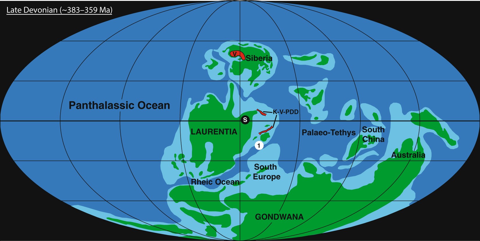
English: Palaeogeographic map of the Late Devonian world, based on ref.77. The location of Steinbruch Schmidt(1), the Siljan impact crater (S), the Viluy Traps (V), and the Kola, Vyatka, and Pripyat–Dniepr–Donets rift systems (K-V-PDD) are indicated. |
| Date | |
| Source | Precisely dating the Frasnian–Famennian boundary: implications for the cause of the Late Devonian mass extinction. Sci Rep 8, 9578 (2018). https://doi.org/10.1038/s41598-018-27847-7 |
| Author | Percival, L.M.E., Davies, J.H.F.L., Schaltegger, U. et al. |
Licensing
This file is licensed under the Creative Commons Attribution 4.0 International license.
- You are free:
- to share – to copy, distribute and transmit the work
- to remix – to adapt the work
- Under the following conditions:
- attribution – You must give appropriate credit, provide a link to the license, and indicate if changes were made. You may do so in any reasonable manner, but not in any way that suggests the licensor endorses you or your use.
File history
Click on a date/time to view the file as it appeared at that time.
| Date/Time | Thumbnail | Dimensions | User | Comment | |
|---|---|---|---|---|---|
| current | 03:20, 25 July 2022 | | 1,651 × 829 (178 KB) | NGPezz | Uploaded a work by Percival, L.M.E., Davies, J.H.F.L., Schaltegger, U. et al. from Precisely dating the Frasnian–Famennian boundary: implications for the cause of the Late Devonian mass extinction. Sci Rep 8, 9578 (2018). https://doi.org/10.1038/s41598-018-27847-7 with UploadWizard |
File usage
No pages on the English Wikipedia use this file (pages on other projects are not listed).
Global file usage
The following other wikis use this file:
- Usage on id.wikipedia.org
- Usage on ne.wikipedia.org
- Usage on si.wikipedia.org
- Usage on tl.wikipedia.org
- Usage on zh.wikipedia.org