Size of this preview: 428 × 599 pixels. Other resolutions: 171 × 240 pixels | 343 × 480 pixels | 548 × 768 pixels | 731 × 1,024 pixels | 2,000 × 2,800 pixels.
Original file (2,000 × 2,800 pixels, file size: 3.44 MB, MIME type: image/png)
| This is a file from the Wikimedia Commons. Information from its description page there is shown below. Commons is a freely licensed media file repository. You can help. |
Summary
| Description |
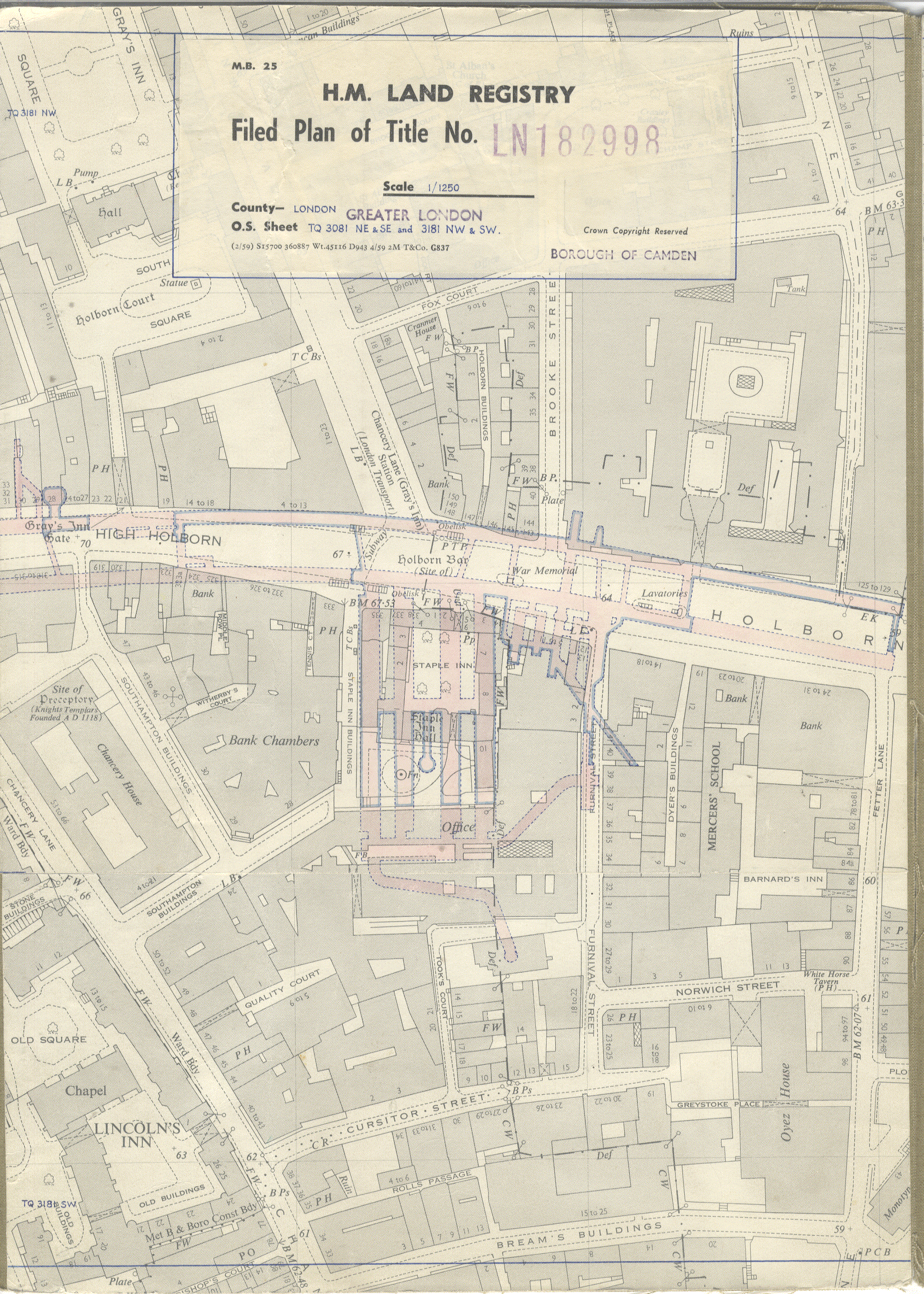
English: Land Registry map showing the Kingsway Telephone Exchange, London, England. |
| Date | |
| Source | https://whoownsengland.org/2017/12/15/how-land-registry-data-reveals-londons-secret-tunnels/ |
| Author | UK Government |
| Camera location | | View this and other nearby images on: OpenStreetMap |
|---|
Licensing
This work created by the United Kingdom Government is in the public domain.
This is because it is one of the following:
HMSO has declared that the expiry of Crown Copyrights applies worldwide (ref: HMSO Email Reply)
|
 |
File history
Click on a date/time to view the file as it appeared at that time.
| Date/Time | Thumbnail | Dimensions | User | Comment | |
|---|---|---|---|---|---|
| current | 23:12, 19 March 2018 | | 2,000 × 2,800 (3.44 MB) | Pigsonthewing | User created page with UploadWizard |
File usage
The following pages on the English Wikipedia use this file (pages on other projects are not listed):
Global file usage
The following other wikis use this file:
- Usage on nl.wikipedia.org
- Usage on www.wikidata.org