
Size of this PNG preview of this SVG file: 800 × 363 pixels. Other resolutions: 320 × 145 pixels | 640 × 290 pixels | 1,024 × 464 pixels | 1,280 × 580 pixels | 2,560 × 1,160 pixels | 4,666 × 2,115 pixels.
Original file (SVG file, nominally 4,666 × 2,115 pixels, file size: 6.63 MB)
| This is a file from the Wikimedia Commons. Information from its description page there is shown below. Commons is a freely licensed media file repository. You can help. |
Summary
| Description |
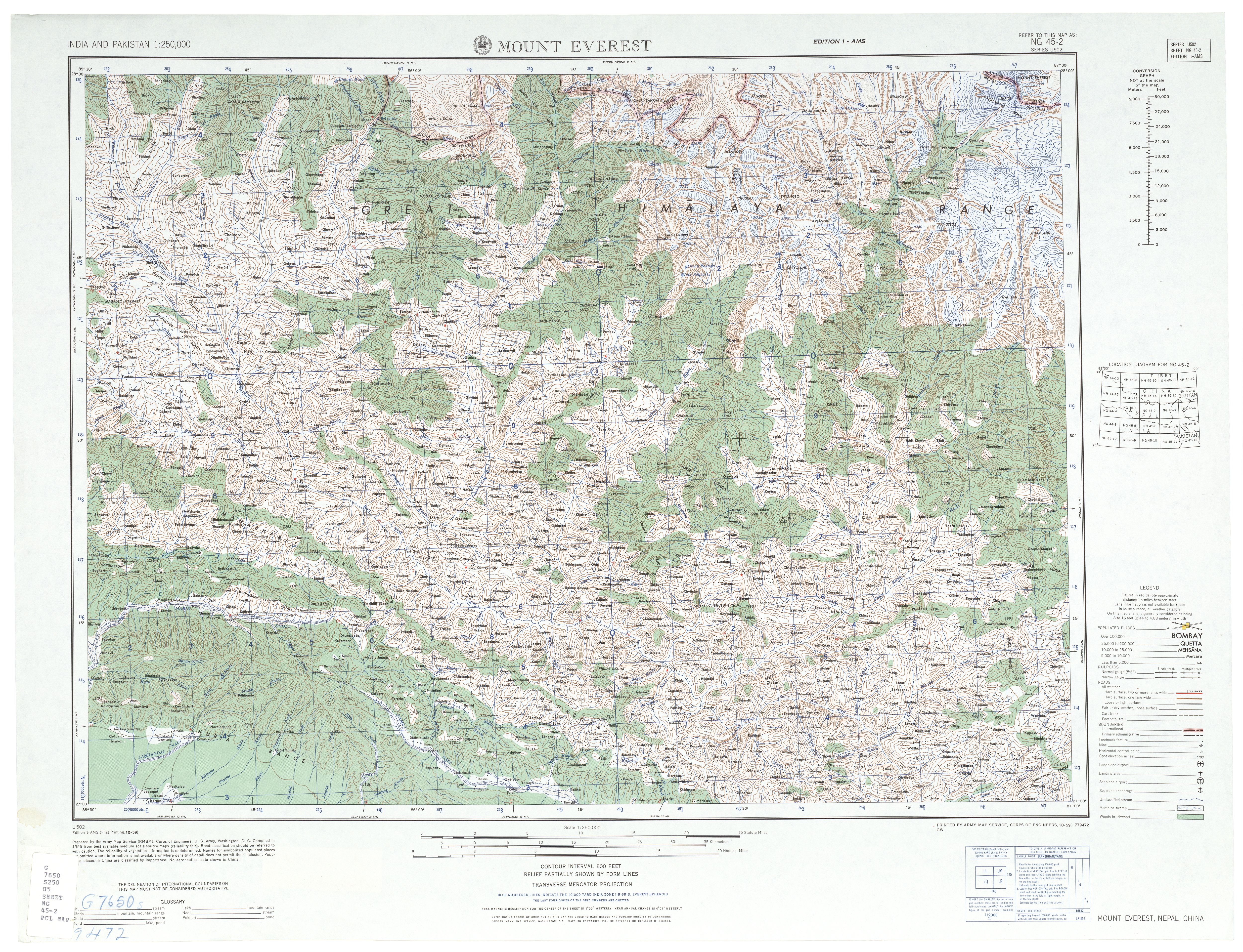
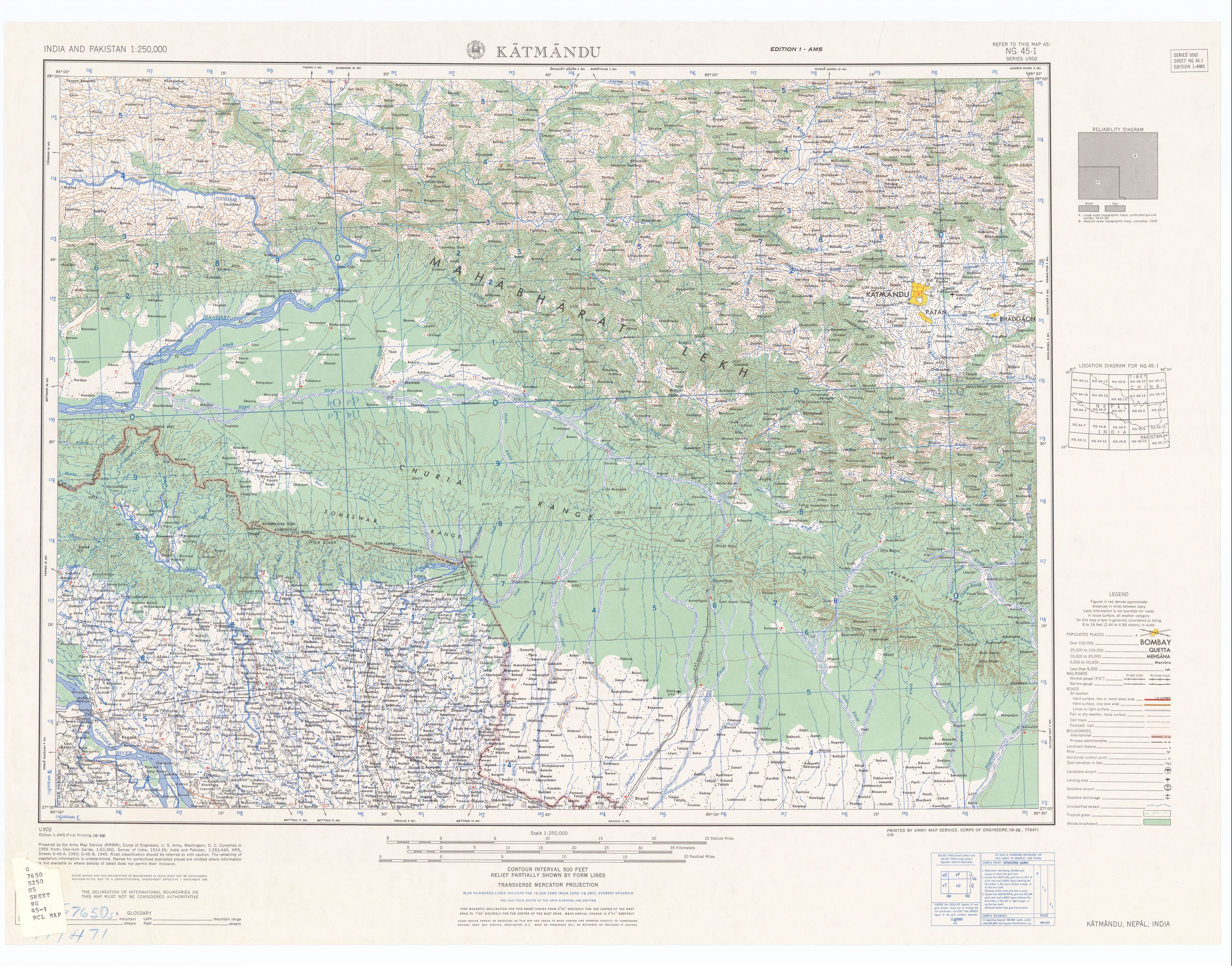
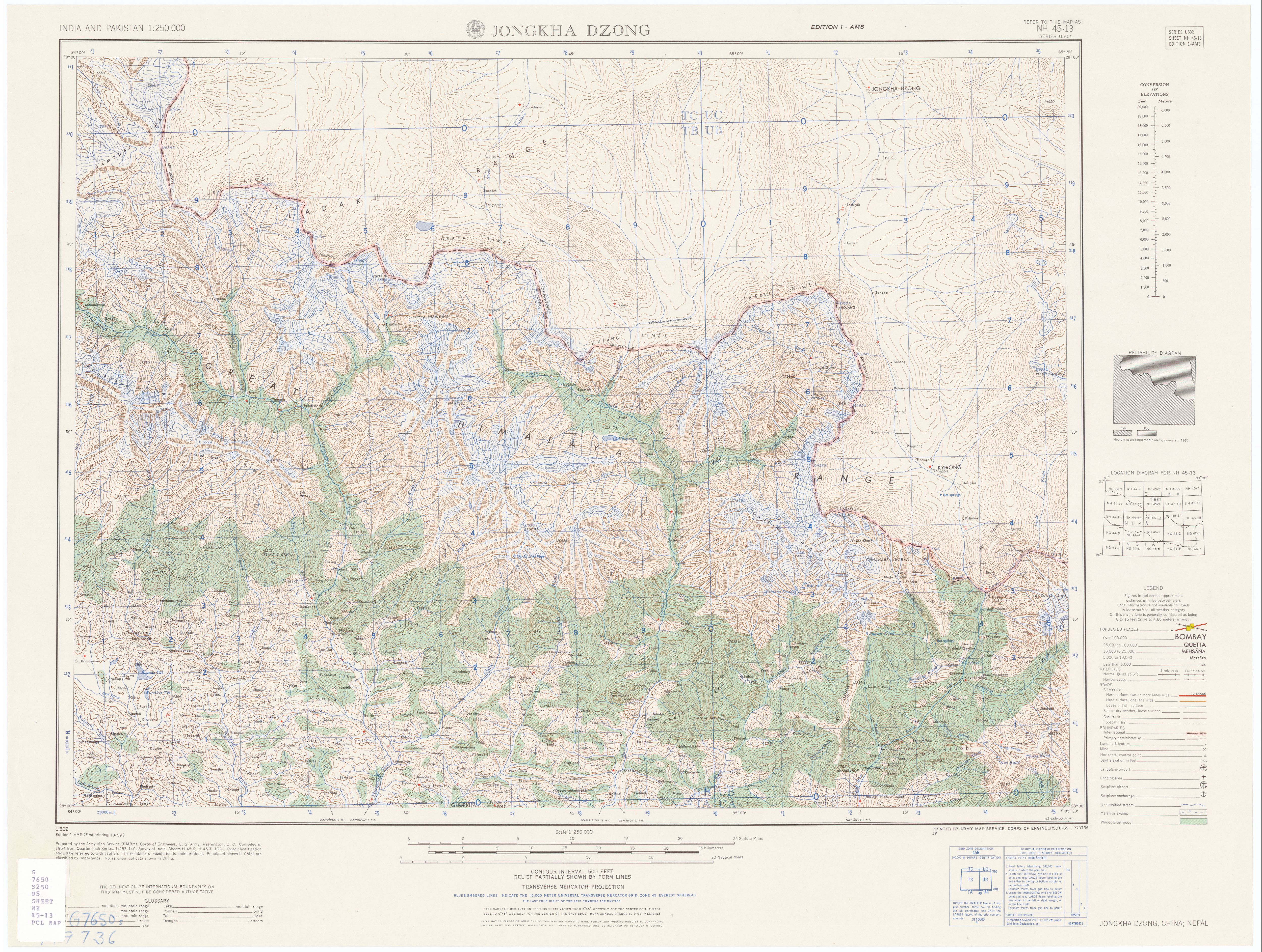
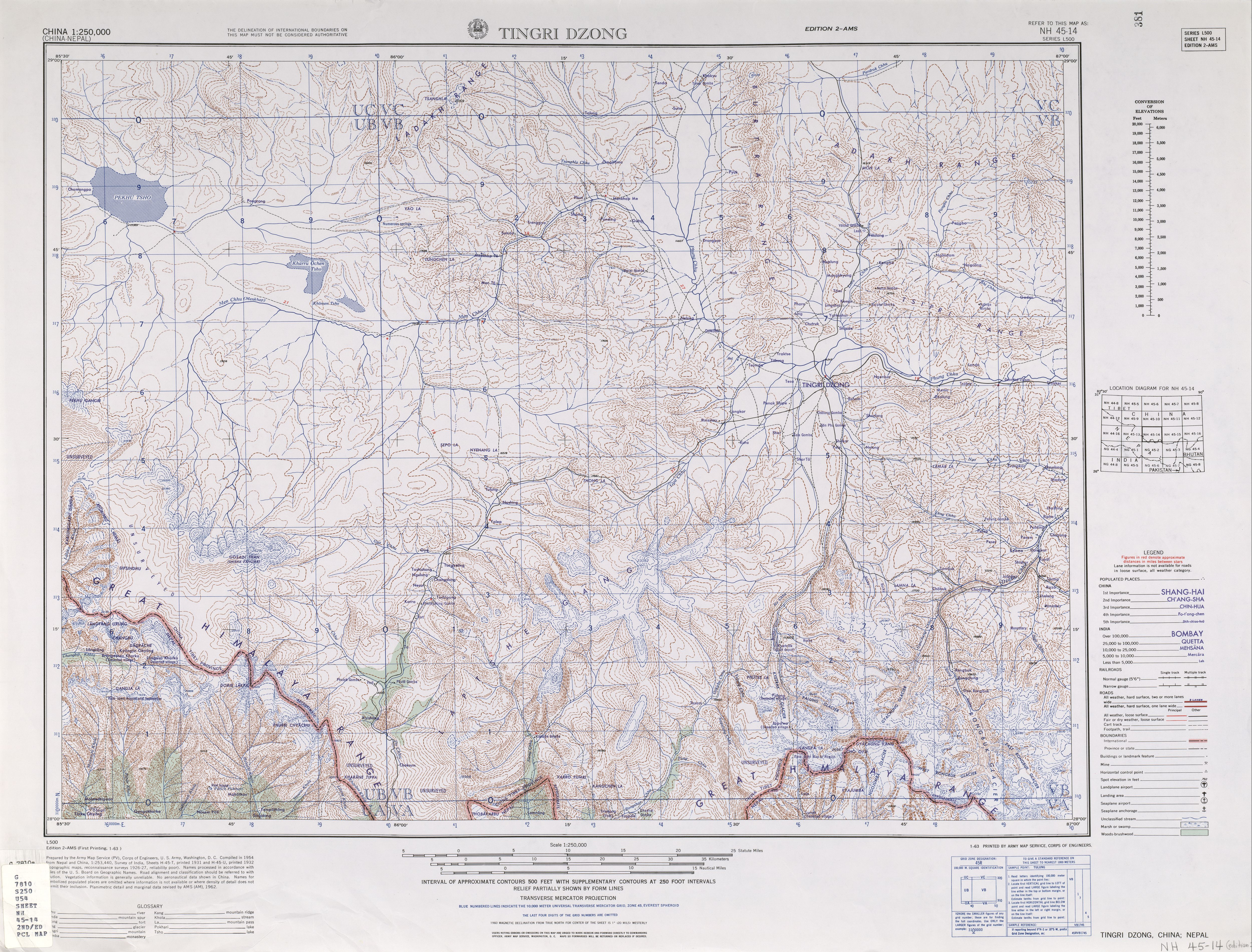
English: NG 45-2 Mount Everest and NG 45-1 Katmandu. Tiles of the Map India and Pakistan 1:250,000. Series U502, U.S. Army Map Service, 1955 (1954 China)
Cropping and annotation by uploader, own work. The red line shows the road existing in 1975 and the black line is the route taken by the 1975 British Mount Everest Southwest Face expedition as described in Bonington, Chris (1976) Everest the Hard Way, London: Hodder and Stoughton ISBN: 0340208333. . The base map shows the then (indeterminate) border so the annotation shows the contemporary border from the Times Atlas/ Google Maps. |
| Date | |
| Source |
http://www.lib.utexas.edu/maps/ams/india/ng-45-02.jpg http://www.lib.utexas.edu/maps/ams/india/ng-45-01.jpg http://www.lib.utexas.edu/maps/ams/india/nh-45-13.jpg http://www.lib.utexas.edu/maps/ams/china/txu-oclc-10552568-nh45-14.jpg |
| Author | U.S. Army Map Service |
Licensing
Base maps:
This work is in the public domain in the United States because it is a work prepared by an officer or employee of the United States Government as part of that person’s official duties under the terms of Title 17, Chapter 1, Section 105 of the US Code.
Note: This only applies to original works of the Federal Government and not to the work of any individual U.S. state, territory, commonwealth, county, municipality, or any other subdivision. This template also does not apply to postage stamp designs published by the United States Postal Service since 1978. (See § 313.6(C)(1) of Compendium of U.S. Copyright Office Practices). It also does not apply to certain US coins; see The US Mint Terms of Use.
|
 | |
| This file has been identified as being free of known restrictions under copyright law, including all related and neighboring rights. | ||
annotation:
This file is licensed under the Creative Commons Attribution 3.0 Unported license.
- You are free:
- to share – to copy, distribute and transmit the work
- to remix – to adapt the work
- Under the following conditions:
- attribution – You must give appropriate credit, provide a link to the license, and indicate if changes were made. You may do so in any reasonable manner, but not in any way that suggests the licensor endorses you or your use.


File history
Click on a date/time to view the file as it appeared at that time.
| Date/Time | Thumbnail | Dimensions | User | Comment | |
|---|---|---|---|---|---|
| current | 20:34, 5 October 2014 | | 4,666 × 2,115 (6.63 MB) | Thincat | Mark Jiri |
| 08:38, 17 September 2014 |  | 4,666 × 2,115 (6.63 MB) | Thincat | Update China-Nepal border from 1955 indeterminate, etc. to current. Add mountain passes. | |
| 22:54, 16 September 2014 |  | 4,666 × 2,115 (6.63 MB) | Thincat | Added rivers | |
| 12:40, 16 September 2014 |  | 4,666 × 2,115 (6.6 MB) | Thincat | Various tidyings | |
| 11:27, 16 September 2014 |  | 4,666 × 2,115 (6.59 MB) | Thincat | Pre-cropping base maps | |
| 09:57, 16 September 2014 |  | 4,603 × 1,909 (25.22 MB) | Thincat | Extending map further north by including two more base maps | |
| 08:09, 16 September 2014 | 4,660 × 1,512 (13.63 MB) | Thincat | User created page with UploadWizard |
File usage
The following pages on the English Wikipedia use this file (pages on other projects are not listed):
Global file usage
The following other wikis use this file:
- Usage on www.wikidata.org