
Size of this preview: 580 × 599 pixels. Other resolutions: 232 × 240 pixels | 464 × 480 pixels | 743 × 768 pixels | 991 × 1,024 pixels | 2,153 × 2,225 pixels.
Original file (2,153 × 2,225 pixels, file size: 573 KB, MIME type: image/png)
| This is a file from the Wikimedia Commons. Information from its description page there is shown below. Commons is a freely licensed media file repository. You can help. |
| Description |
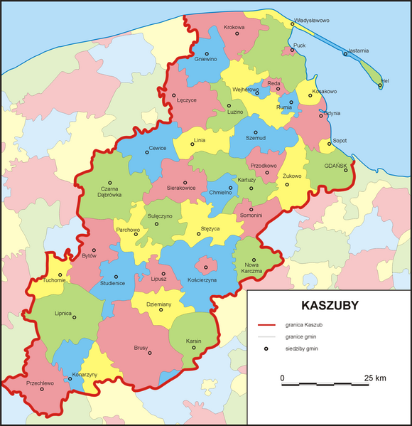
Polski: Mapa podziału administracyjnego współczesnych Kaszub wg dr Jana Mordawskiego
English: Map of administrative units nad parts of administrative units classified to be inhabited by Kashubians by dr Jan Mordawski |
| Date | 1999, wektoryzacja (14.08.2011) |
| Source |
Own work na podstawie:
|
| Author | Jan Mordawski & Poznaniak (wektoryzacja) |
| Permission (Reusing this file) |
I, the copyright holder of this work, hereby publish it under the following license: This file is licensed under the Creative Commons Attribution-Share Alike 3.0 Unported license.
|
File history
Click on a date/time to view the file as it appeared at that time.
| Date/Time | Thumbnail | Dimensions | User | Comment | |
|---|---|---|---|---|---|
| current | 13:43, 27 September 2011 | | 2,153 × 2,225 (573 KB) | Poznaniak | x |
| 15:14, 14 August 2011 |  | 2,586 × 2,666 (535 KB) | Poznaniak | x |
File usage
No pages on the English Wikipedia use this file (pages on other projects are not listed).
Global file usage
The following other wikis use this file:
- Usage on af.wiktionary.org
- Usage on bg.wikipedia.org
- Usage on cs.wikipedia.org
- Usage on de.wikipedia.org
- Usage on dsb.wikipedia.org
- Usage on eo.wikipedia.org
- Usage on es.wikipedia.org
- Usage on fa.wikipedia.org
- Usage on fr.wikipedia.org
- Usage on gv.wikipedia.org
- Usage on hr.wikipedia.org
- Usage on hsb.wikipedia.org
- Usage on it.wikipedia.org
- Usage on la.wikipedia.org
- Usage on lt.wikipedia.org
- Usage on mk.wikipedia.org
- Usage on nl.wikipedia.org
- Usage on pl.wikipedia.org
- Usage on pt.wikipedia.org
- Usage on ro.wikipedia.org
- Usage on sk.wikipedia.org
- Usage on sr.wikipedia.org
- Usage on stq.wikipedia.org
- Usage on sv.wikipedia.org
- Usage on uk.wikipedia.org
- Usage on vi.wikipedia.org