No higher resolution available.
KamchatkaKorfaBay.png (412 × 309 pixels, file size: 38 KB, MIME type: image/png)
| This is a file from the Wikimedia Commons. Information from its description page there is shown below. Commons is a freely licensed media file repository. You can help. |
Summary
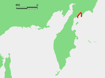
| Description | Locator map of Korfa Bay in Kamchatka (Russia) | ||
| Date | 06/07/2024 | ||
| Source | Own work derived from "KamchatkaKaraginskiyGulf.png" by Insider | ||
| Author | molorco | ||
| Permission (Reusing this file) |
|
Licensing
| I, the copyright holder of this work, release this work into the public domain. This applies worldwide. In some countries this may not be legally possible; if so: I grant anyone the right to use this work for any purpose, without any conditions, unless such conditions are required by law. |
File history
Click on a date/time to view the file as it appeared at that time.
| Date/Time | Thumbnail | Dimensions | User | Comment | |
|---|---|---|---|---|---|
| current | 13:32, 6 July 2024 | | 412 × 309 (38 KB) | Molorco | {{Information |Description=Locator map of Korfa Bay in Kamchatka (Russia) |Source=Own work derived from "https://commons.wikimedia.org/wiki/File:KamchatkaKaraginskiyGulf.png KamchatkaKaraginskiyGulf.png" by Insider |Date=06/07/2024 |Author=molorco |Permission= {{PD-self}} |other_versions= }} |
File usage
The following pages on the English Wikipedia use this file (pages on other projects are not listed):
Global file usage
The following other wikis use this file:
- Usage on es.wikipedia.org