Size of this preview: 800 × 600 pixels. Other resolutions: 320 × 240 pixels | 640 × 480 pixels | 1,024 × 768 pixels | 1,280 × 960 pixels | 2,576 × 1,932 pixels.
Original file (2,576 × 1,932 pixels, file size: 962 KB, MIME type: image/jpeg)
| This is a file from the Wikimedia Commons. Information from its description page there is shown below. Commons is a freely licensed media file repository. You can help. |
Summary
| Description |
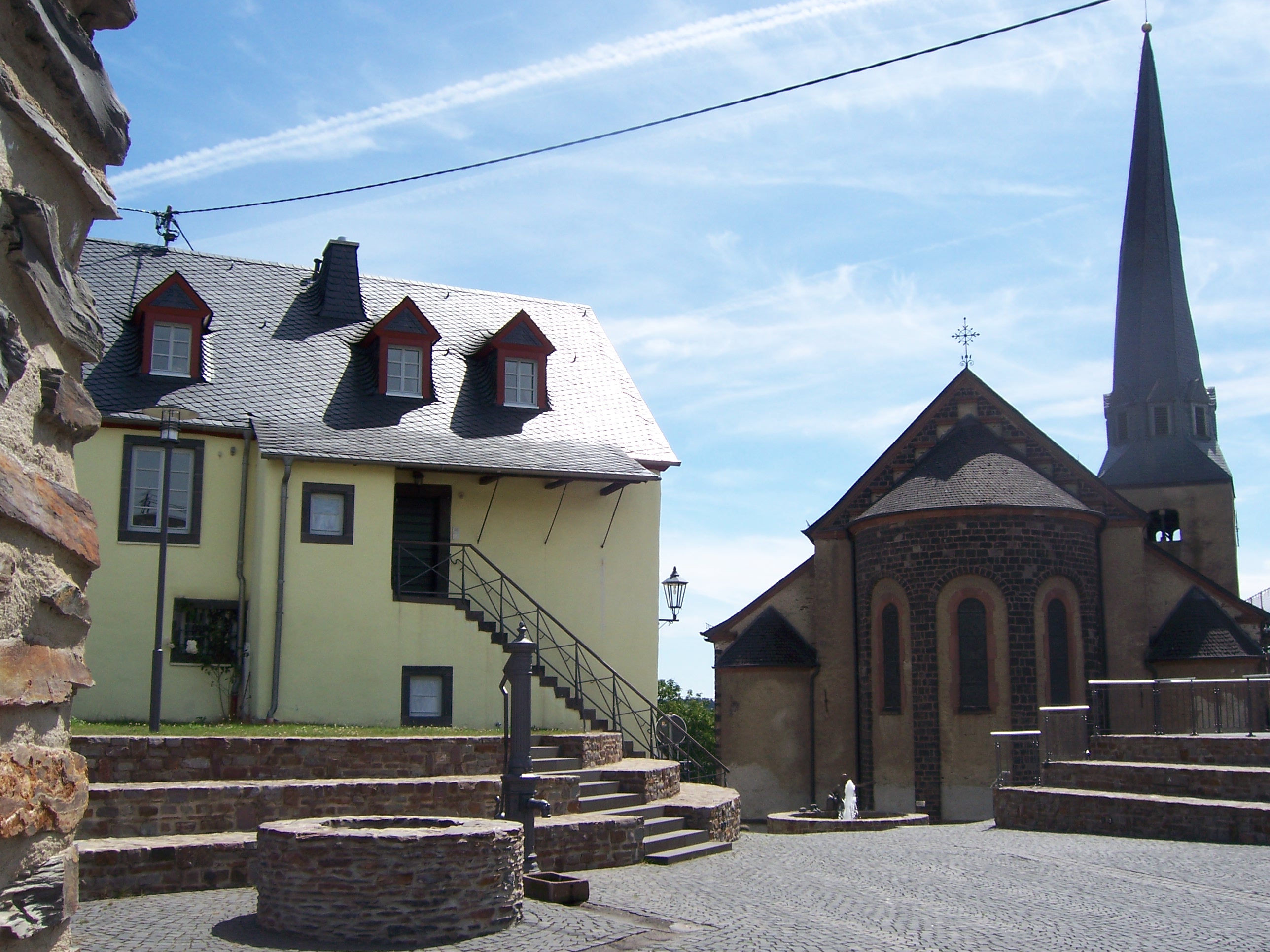
English: The new historical centre of Kaisersesch. In the background you can see the prison.
Deutsch: Der neu erbaute historische Ortskern von Kaisersesch. Im Hintergrund das Prison. |
| Date | |
| Source | Own work |
| Author | A1bi |
| Other versions |
.jpg) |
| Camera location | | View this and other nearby images on: OpenStreetMap |
|---|
Licensing
| I, the copyright holder of this work, release this work into the public domain. This applies worldwide. In some countries this may not be legally possible; if so: I grant anyone the right to use this work for any purpose, without any conditions, unless such conditions are required by law. |
File history
Click on a date/time to view the file as it appeared at that time.
| Date/Time | Thumbnail | Dimensions | User | Comment | |
|---|---|---|---|---|---|
| current | 17:45, 13 November 2009 | | 2,576 × 1,932 (962 KB) | A1bi | {{Information |Description={{en|1=The new historical centre of Kaisersesch. In the background you can see the prison.}} {{de|1=Der neu erbaute historische Ortskern von Kaisersesch. Im Hintergrund das Prison.}} |Source={{own}} |Author=A1bi |D |
File usage
No pages on the English Wikipedia use this file (pages on other projects are not listed).
Global file usage
The following other wikis use this file:
- Usage on azb.wikipedia.org
- Usage on de.wikipedia.org
- Usage on nl.wikipedia.org
- Usage on pt.wikipedia.org
- Usage on tr.wikipedia.org
- Usage on uk.wikipedia.org
- Usage on www.wikidata.org