Size of this preview: 800 × 419 pixels. Other resolutions: 320 × 167 pixels | 640 × 335 pixels | 1,024 × 536 pixels | 1,280 × 670 pixels | 2,560 × 1,339 pixels | 6,048 × 3,164 pixels.
Original file (6,048 × 3,164 pixels, file size: 5.6 MB, MIME type: image/jpeg)
| This is a file from the Wikimedia Commons. Information from its description page there is shown below. Commons is a freely licensed media file repository. You can help. |
Summary
| Description |
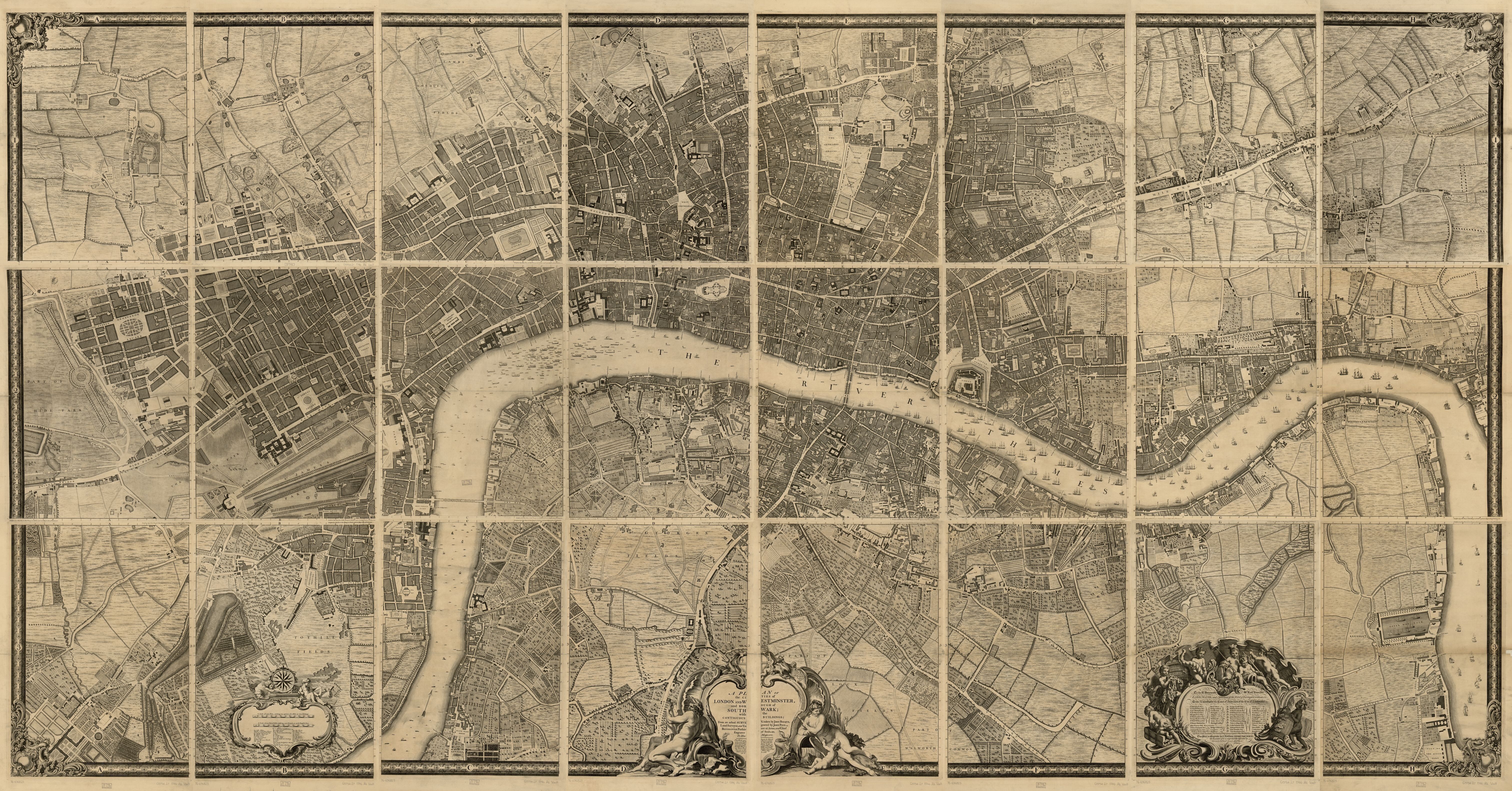
English: A plan of the cities of London and Westminster, and borough of Southwark, with the contiguous buildings |
| Date | |
| Source | Rocque, John, -1762, John Pine, and John Tinney. A plan of the cities of London and Westminster, and borough of Southwark, with the contiguous buildings. London, John Pine & John Tinney, 1746. Map. https://www.loc.gov/item/76696823/. jpeg 6048x3164 px |
| Author |
Rocque, John, -1762. Pine, John, 1690-1756. Tinney, John |
Licensing
|
This is a faithful photographic reproduction of a two-dimensional, public domain work of art. The work of art itself is in the public domain for the following reason:
The official position taken by the Wikimedia Foundation is that "faithful reproductions of two-dimensional public domain works of art are public domain".
This photographic reproduction is therefore also considered to be in the public domain in the United States. In other jurisdictions, re-use of this content may be restricted; see Reuse of PD-Art photographs for details. | ||||
File history
Click on a date/time to view the file as it appeared at that time.
| Date/Time | Thumbnail | Dimensions | User | Comment | |
|---|---|---|---|---|---|
| current | 13:49, 22 May 2019 | | 6,048 × 3,164 (5.6 MB) | Thincat | User created page with UploadWizard |
File usage
No pages on the English Wikipedia use this file (pages on other projects are not listed).
Global file usage
The following other wikis use this file:
- Usage on www.wikidata.org