
Size of this preview: 612 × 600 pixels. Other resolutions: 245 × 240 pixels | 490 × 480 pixels | 784 × 768 pixels | 1,045 × 1,024 pixels | 2,090 × 2,048 pixels | 3,620 × 3,548 pixels.
Original file (3,620 × 3,548 pixels, file size: 3.26 MB, MIME type: image/jpeg)
| This is a file from the Wikimedia Commons. Information from its description page there is shown below. Commons is a freely licensed media file repository. You can help. |
Summary
| Description |
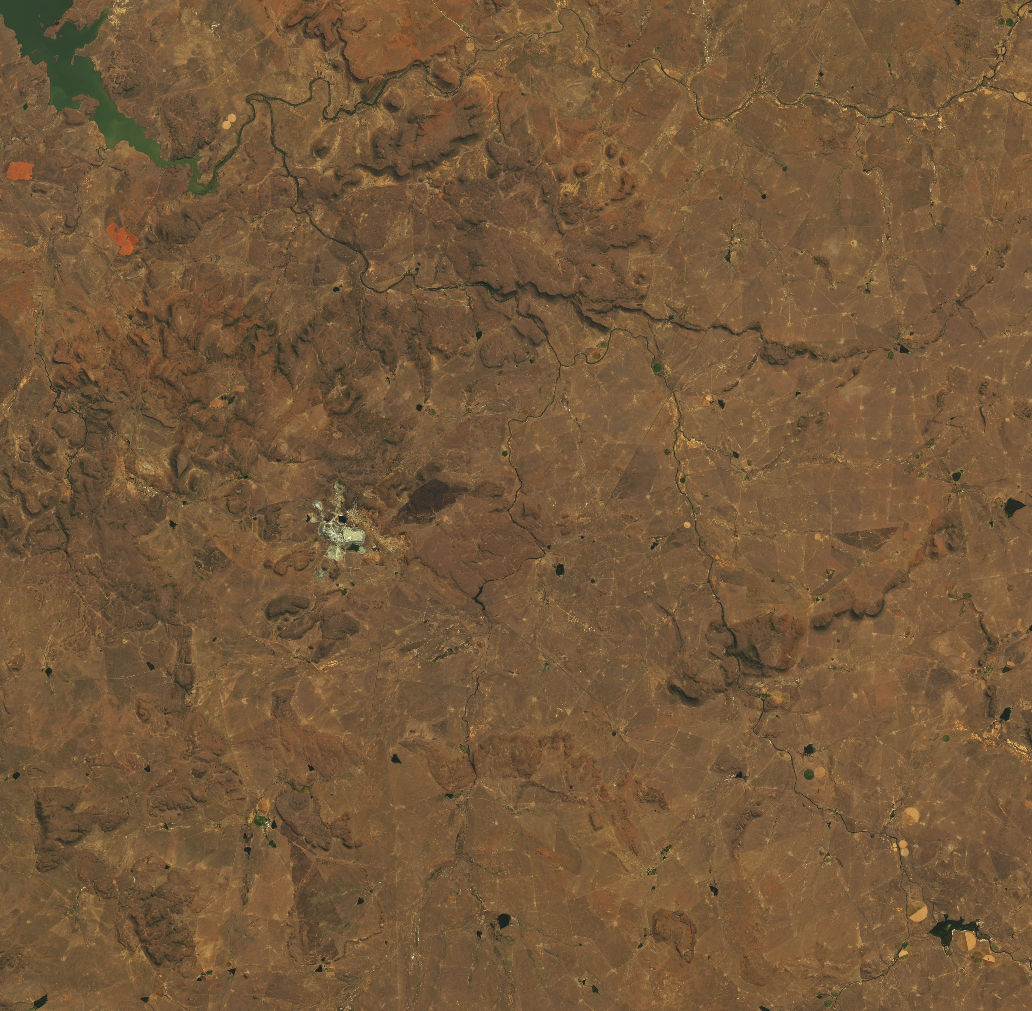
English: On September 11, 2022, a dam collapsed at a diamond mine in Jagersfontein, South Africa, and released a watery mixture of mining waste known as tailings. The sludge poured across the landscape, destroying homes, inundating rivers and grazing land, and injuring dozens. The Operational Land Imager (OLI) on Landsat 8 acquired the image on September 10, the day before the dam collapse. |
| Date | |
| Source | Image and description |
| Author | NASA Earth Observatory image created by Lauren Dauphin, using Operational Land Imager (OLI) on Landsat 8; data provided courtesy of the U.S. Geological Survey team. |
Licensing
| This file is in the public domain in the United States because it was solely created by NASA. NASA copyright policy states that "NASA material is not protected by copyright unless noted". (See Template:PD-USGov, NASA copyright policy page or JPL Image Use Policy.) | ||
 |
Warnings:
|
File history
Click on a date/time to view the file as it appeared at that time.
| Date/Time | Thumbnail | Dimensions | User | Comment | |
|---|---|---|---|---|---|
| current | 10:09, 24 May 2023 | | 3,620 × 3,548 (3.26 MB) | Maqdisi | Uploaded a work by NASA Earth Observatory image created by Lauren Dauphin, using Operational Land Imager (OLI) on Landsat 8; data provided courtesy of the U.S. Geological Survey team. from [https://eoimages.gsfc.nasa.gov/images/imagerecords/150000/150497/minesafrica_oli_2022253_lrg.jpg Image] and [https://earthobservatory.nasa.gov/images/150497/jagersfontein-covered-in-mining-waste description] with UploadWizard |
File usage
The following pages on the English Wikipedia use this file (pages on other projects are not listed):