_map.svg)
_map.svg&action=edit&redlink=1)

Size of this PNG preview of this SVG file: 756 × 600 pixels. Other resolutions: 303 × 240 pixels | 605 × 480 pixels | 968 × 768 pixels | 1,280 × 1,016 pixels | 2,560 × 2,032 pixels | 1,066 × 846 pixels.
Original file (SVG file, nominally 1,066 × 846 pixels, file size: 540 KB)
| This is a file from the Wikimedia Commons. Information from its description page there is shown below. Commons is a freely licensed media file repository. You can help. |
_map.svg)
Summary
| Description |
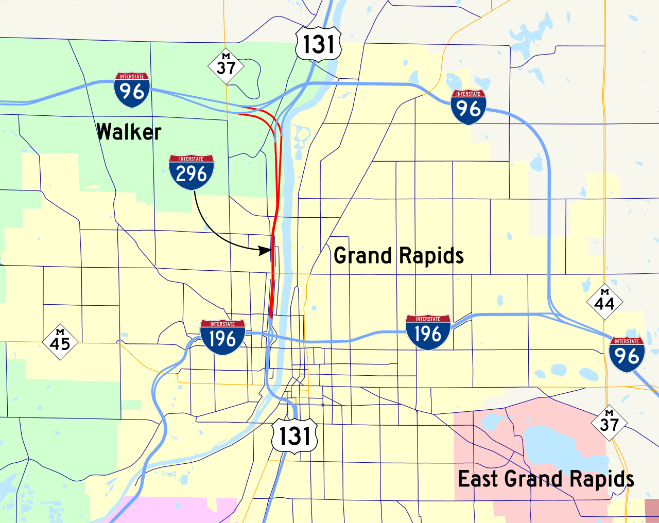
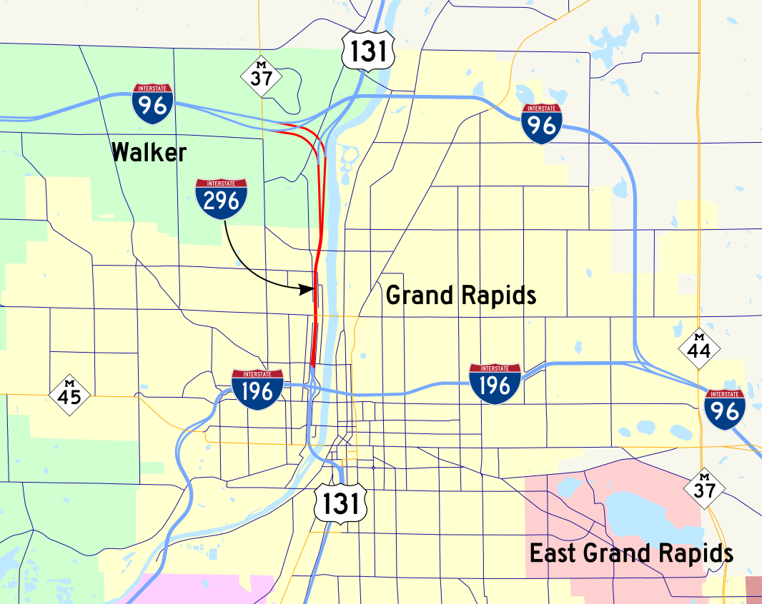
English: Map of hidden Interstate 296 |
| Date | |
| Source | Own work by uploader using Michigan GIS data |
| Author | KelleyCook |
Licensing
| I, the copyright holder of this work, release this work into the public domain. This applies worldwide. In some countries this may not be legally possible; if so: I grant anyone the right to use this work for any purpose, without any conditions, unless such conditions are required by law. |
File history
Click on a date/time to view the file as it appeared at that time.
| Date/Time | Thumbnail | Dimensions | User | Comment | |
|---|---|---|---|---|---|
| current | 02:08, 19 December 2013 | | 1,066 × 846 (540 KB) | Imzadi1979 | recoloring the urban areas, converting text to path after setting a font choice |
| 23:36, 27 August 2008 |  | 1,066 × 846 (543 KB) | KelleyCook | {{Information |Description={{en|1=Map of hidden Interstate 296}} |Source=Own work by uploader using Michigan GIS data |Author=KelleyCook |Date= |Permission= |other_versions= }} <!--{{ImageUpload|full}}--> Category:Interstate 296 [ |
File usage
No pages on the English Wikipedia use this file (pages on other projects are not listed).
_map.svg)