
Size of this PNG preview of this SVG file: 794 × 600 pixels. Other resolutions: 318 × 240 pixels | 635 × 480 pixels | 1,016 × 768 pixels | 1,280 × 967 pixels | 2,560 × 1,935 pixels | 1,588 × 1,200 pixels.
Original file (SVG file, nominally 1,588 × 1,200 pixels, file size: 506 KB)
| This is a file from the Wikimedia Commons. Information from its description page there is shown below. Commons is a freely licensed media file repository. You can help. |
Summary
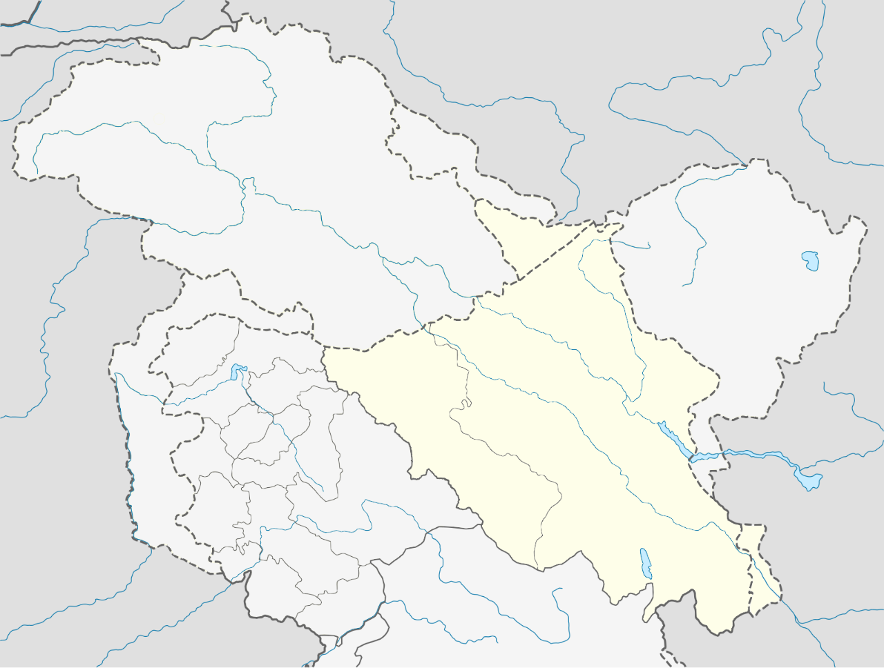
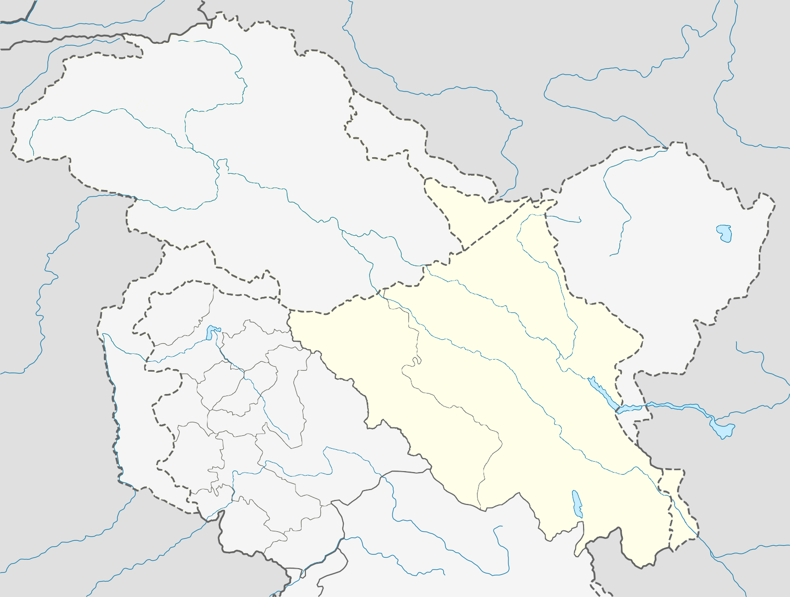
| Description | Quadratische Plattkarte, N-S-Streckung 120 %. Geographische Begrenzung der Karte: * N: 37.2° N * S: 32.1° N * W: 72.4° O * O: 80.5° O Equirectangular projection, N/S stretching 120 %. Geographic limits of the map: * N: 37.2° N * S: 32.1° N * W: 72.4° E * E: 80.5° E |
| Date | |
| Source | |
| Author |
|
| This is a retouched picture, which means that it has been digitally altered from its original version. Modifications: new political boundaries. The original can be viewed here: India Jammu and Kashmir location map.svg:
|
I, the copyright holder of this work, hereby publish it under the following license:
This file is licensed under the Creative Commons Attribution-Share Alike 3.0 Unported license.
- You are free:
- to share – to copy, distribute and transmit the work
- to remix – to adapt the work
- Under the following conditions:
- attribution – You must give appropriate credit, provide a link to the license, and indicate if changes were made. You may do so in any reasonable manner, but not in any way that suggests the licensor endorses you or your use.
- share alike – If you remix, transform, or build upon the material, you must distribute your contributions under the same or compatible license as the original.
Original upload log
This image is a derivative work of the following images:
- File:India_Jammu_and_Kashmir_location_map.svg licensed with Cc-by-sa-3.0
- 2011-02-16T13:08:20Z NordNordWest 1722x1301 (196067 Bytes) Who cares discussions (discussion? only you: http://en.wikipedia.org/w/index.php?title=File_talk:India_Jammu_and_Kashmir_location_map.svg&action=history) at en:WP when this is a Commons file? Another revert by you -> COM:V.
- 2011-02-16T12:46:34Z Avoided blue 1722x1301 (259968 Bytes) Discussion was there on en:wiki for long time, the map otherwise is completely misleading
- 2011-02-15T12:10:59Z NordNordWest 1722x1301 (196067 Bytes) see [[:en:Kashmir conflict]], especially [[:en:Kashmir conflict#Indian view]], and [[:en:Instrument of Accession (Jammu and Kashmir)]], no changes of difficult maps without discussion
- 2011-02-15T06:47:01Z Avoided blue 1722x1301 (259968 Bytes) Fix colors of areas that are not militarily controlled by India.
- 2010-04-15T08:35:10Z NordNordWest 1722x1301 (196067 Bytes) =={{int:filedesc}}== {{Information |Description= {{de|Positionskarte von [[:de:Jammu und Kashmir|Jammu und Kashmir]], [[:de:Indien|Indien]]}} Quadratische Plattkarte, N-S-Streckung 120 %. Geographische Begrenzung der Karte: *
File history
Click on a date/time to view the file as it appeared at that time.
| Date/Time | Thumbnail | Dimensions | User | Comment | |
|---|---|---|---|---|---|
| current | 01:45, 27 November 2019 | | 1,588 × 1,200 (506 KB) | Fowler&fowler | Reverted to version as of 03:02, 26 November 2019 (UTC) Sorry I made a mistake. |
| 01:40, 27 November 2019 |  | 2,000 × 1,511 (591 KB) | Fowler&fowler | Reverted to version as of 17:09, 25 November 2019 (UTC); We cannot show a POV map which colors the two regions of Pakistan administered Kashmir in different colors. See the discussion in #Uniform_format_for_infobox_of_Kashmir-related_first-order_division_articles and Talk:Jammu_and_Kashmir_(union_territory)#Three_map_proposal | |
| 03:02, 26 November 2019 |  | 1,588 × 1,200 (506 KB) | Hindian1947 | Showing current situation after the bifurcation of Ladakh from Jammu and Kashmir. | |
| 17:09, 25 November 2019 |  | 2,000 × 1,511 (591 KB) | Fowler&fowler | Restoring {{U|NordNordWest}} original map showing the de facto situation; removing the current map which shows the India government viewpoint per the discussion on WT:INDIA see [https://en.wikipedia.org/w/index.php?title=Wikipedia_talk:Noticeboard_for_India-related_topics&oldid=927910702#Uniform_format_for_infobox_of_Kashmir-related_first-order_division_articles here]. ~~~~ | |
| 20:17, 2 November 2019 |  | 1,722 × 1,301 (307 KB) | RaviC | {{Information |Description={{de|Positionskarte von Ladakh, Indien. De-facto-Situation.}} Quadratische Plattkarte, N-S-Streckung 120 %. Geographische Begrenzung der Karte: * N: 37.2° N * S: 32.1° N * W: 72.4° O * O: 80.5° O {{en|Location map of Ladakh, India. De facto situation.}} Equirectangular projection, N/S stretching 120 %. Geographic limits of the map: * N: 37.2° N * S: 32.1° N * W: 72.4° E * E: 80.5° E |Source=*[[:File:India_Ja... |
File usage
The following pages on the English Wikipedia use this file (pages on other projects are not listed):
Global file usage
The following other wikis use this file:
- Usage on os.wikipedia.org
- Usage on ru.wikipedia.org
- Usage on uk.wikipedia.org