No higher resolution available.
Huntsville,_Alabama_area_map.png (422 × 359 pixels, file size: 14 KB, MIME type: image/png)
| This is a file from the Wikimedia Commons. Information from its description page there is shown below. Commons is a freely licensed media file repository. You can help. |
Summary
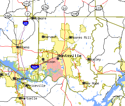
| Description | |
| Source | |
| Author |
![[1]](https://tiger.census.gov/cgi-bin/mapper/map.gif?&lat=34.74525&lon=-86.58983&ht=0.720&wid=0.720&&on=CITIES&on=places&on=railroad&off=streets&off=tracts&on=interstate&on=statehwy&off=street_names&tlevel=-&tvar=-&tmeth=i&mlat=&mlon=&msym=redpin&mlabel=35801__Huntsville_&murl=&conf=mapnew.con&iht=359&iwd=422)
Licensing
This image or file is a work of a United States Census Bureau employee, taken or made as part of that person's official duties. As a work of the U.S. federal government, the image is in the public domain.
|
 |
Original upload log
The original description page was here. All following user names refer to en.wikipedia.
| Date/Time | Dimensions | User | Comment |
|---|---|---|---|
| 2004-09-06 00:09 | 422×359× (14473 bytes) | Ke4roh | Tiger map [http://tiger.census.gov/cgi-bin/mapper/map.gif?&lat=34.74525&lon=-86.58983&ht=0.720&wid=0.720&&on=CITIES&on=places&on=railroad&off=streets&off=tracts&on=interstate&on=statehwy&off=street_names&tlevel=-&tvar=-&tmeth=i&mlat=&mlon=&msym=redpin&mla |
File history
Click on a date/time to view the file as it appeared at that time.
| Date/Time | Thumbnail | Dimensions | User | Comment | |
|---|---|---|---|---|---|
| current | 11:39, 6 March 2016 | | 422 × 359 (14 KB) | FastilyClone | Transferred from enwp |
File usage
The following pages on the English Wikipedia use this file (pages on other projects are not listed):