Size of this preview: 800 × 504 pixels. Other resolutions: 320 × 202 pixels | 640 × 403 pixels | 1,024 × 645 pixels | 1,280 × 806 pixels | 2,396 × 1,509 pixels.
Original file (2,396 × 1,509 pixels, file size: 3.49 MB, MIME type: image/jpeg)
| This is a file from the Wikimedia Commons. Information from its description page there is shown below. Commons is a freely licensed media file repository. You can help. |
Summary
| Description |
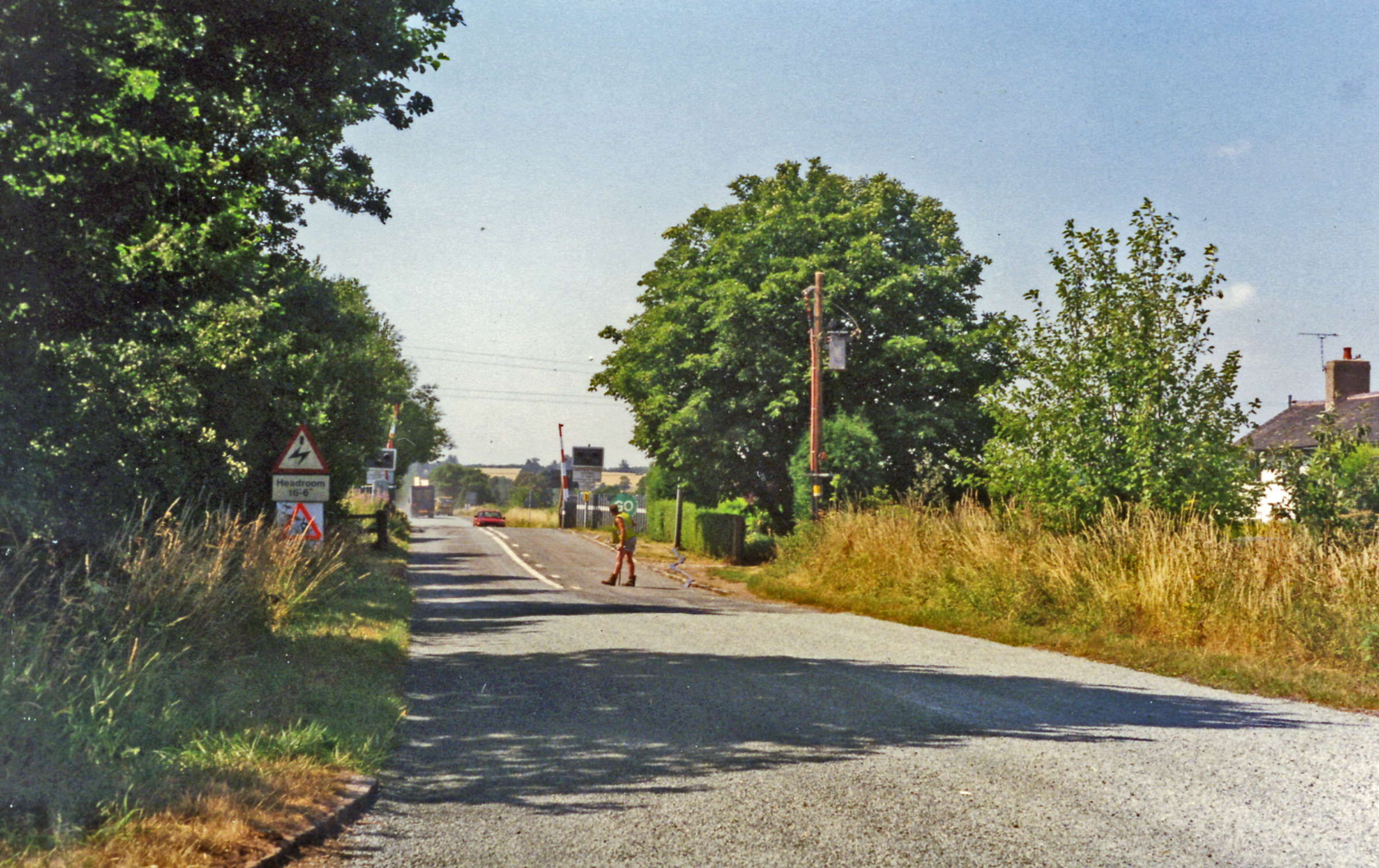
English: Approaching crossing at site of Hixon station, 1995
View westward, the station (unstaffed Halt since 20/7/31, closed 6/1/47 when local services ceased) had been on the left: ex-North Stafford Stone (to right) - Colwich (to left) loop used by London Euston - Manchester through trains running via Stoke-on-Trent and electrified in 1965-66. There was an RAF Airfield close by and the line was frequently blocked by crashing aircraft during World War Two, but the site is famous for the extraordinary accident of 6/1/68 when an express crashed into a low-loader creeping across the level-crossing carrying a 120-ton electrical transformer. |
| Date | |
| Source | From geograph.org.uk |
| Author | Ben Brooksbank |
| Permission (Reusing this file) |
Creative Commons Attribution Share-alike license 2.0 |
| Attribution (required by the license) | Ben Brooksbank / Approaching crossing at site of Hixon station, 1995 / |
| Camera location | | View this and other nearby images on: OpenStreetMap |
|---|
Licensing

|
This image was taken from the Geograph project collection. See this photograph's page on the Geograph website for the photographer's contact details. The copyright on this image is owned by Ben Brooksbank and is licensed for reuse under the Creative Commons Attribution-ShareAlike 2.0 license.
|
This file is licensed under the Creative Commons Attribution-Share Alike 2.0 Generic license.
Attribution: Ben Brooksbank
- You are free:
- to share – to copy, distribute and transmit the work
- to remix – to adapt the work
- Under the following conditions:
- attribution – You must give appropriate credit, provide a link to the license, and indicate if changes were made. You may do so in any reasonable manner, but not in any way that suggests the licensor endorses you or your use.
- share alike – If you remix, transform, or build upon the material, you must distribute your contributions under the same or compatible license as the original.
File history
Click on a date/time to view the file as it appeared at that time.
| Date/Time | Thumbnail | Dimensions | User | Comment | |
|---|---|---|---|---|---|
| current | 12:51, 18 October 2013 | | 2,396 × 1,509 (3.49 MB) | Chevin | == {{int:filedesc}} == {{Information |Description={{en|1='''Approaching crossing at site of Hixon station, 1995 View westward, the station (unstaffed Halt since 20/7/31, closed 6/1/47 when local services ceased) had been on the left: ex-North Stafford ... |
File usage
The following pages on the English Wikipedia use this file (pages on other projects are not listed):