Size of this preview: 800 × 543 pixels. Other resolutions: 320 × 217 pixels | 640 × 434 pixels | 960 × 651 pixels.
Original file (960 × 651 pixels, file size: 76 KB, MIME type: image/jpeg)
| This is a file from the Wikimedia Commons. Information from its description page there is shown below. Commons is a freely licensed media file repository. You can help. |
Summary
| Description |
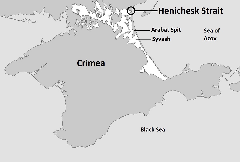
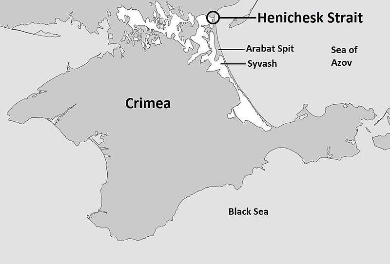
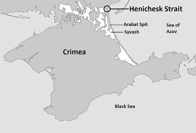
English: Map of the entire Crimea highlighting the Henichesk Strait, the body of water separating the Syvash with the Sea of Azov |
| Date | |
| Source | Own work based on: Sevastopol location map.svg |
| Author | Kelvinsong |
Licensing
| This work has been released into the public domain by its author, Kelvinsong. This applies worldwide. In some countries this may not be legally possible; if so: |
File history
Click on a date/time to view the file as it appeared at that time.
| Date/Time | Thumbnail | Dimensions | User | Comment | |
|---|---|---|---|---|---|
| current | 05:10, 5 October 2014 | | 960 × 651 (76 KB) | Herostratus | ==Summary== {{Information |Description = Map of the entire Crimea highlighting the Syvash, the body of water separating the Crimea from the Ukraine |Source = https://commons.wikimedia.org/wiki/File:Sevastopol_location_map.svg |Date = 1 March 2014 (date... |
File usage
The following pages on the English Wikipedia use this file (pages on other projects are not listed):
Global file usage
The following other wikis use this file:
- Usage on hr.wikipedia.org
- Usage on nl.wikipedia.org
- Usage on sv.wikipedia.org