Size of this preview: 600 × 600 pixels. Other resolutions: 240 × 240 pixels | 480 × 480 pixels | 768 × 768 pixels | 1,200 × 1,200 pixels.
Original file (1,200 × 1,200 pixels, file size: 70 KB, MIME type: image/png)
| This is a file from the Wikimedia Commons. Information from its description page there is shown below. Commons is a freely licensed media file repository. You can help. |
Summary
| Description |
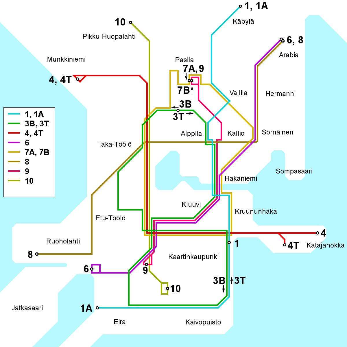
English: A map of the Helsinki tram network as it will appear following the opening of line 9 on 2008-08-10. All names in Finnish. This map will be outdated following the rerouting on lines 3B and 3T, projected to take place on 2009-03-30. After that date, use File:Helsinki tram map.png instead.
Suomi: Kartta Helsingin raitiotielinjoista sellaisena kuin se on linjan 9 aloitettua liikennöinnin 10. elokuuta 2008. Tämä kartta tulee vanhenemaan 30. 3. 2009 tapahtuvaksi suunniteltujen linjojen 3B ja 3T reittimuutosten jälkeen. 30. 3. 2009 eteenpäin voimassa oleva kartta on löydettävissä täältä: File:Helsinki tram map.png. |
| Date | |
| Source | Own work |
| Author | Kalle Id |
| Other versions | Swedish version: Image:Helsinki tram map 2008-08-10 sv.png |
Licensing
I, the copyright holder of this work, hereby publish it under the following license:
This file is licensed under the Creative Commons Attribution-Share Alike 3.0 Unported license.
- You are free:
- to share – to copy, distribute and transmit the work
- to remix – to adapt the work
- Under the following conditions:
- attribution – You must give appropriate credit, provide a link to the license, and indicate if changes were made. You may do so in any reasonable manner, but not in any way that suggests the licensor endorses you or your use.
- share alike – If you remix, transform, or build upon the material, you must distribute your contributions under the same or compatible license as the original.

|
This transport map image could be re-created using vector graphics as an SVG file. This has several advantages; see Commons:Media for cleanup for more information. If an SVG form of this image is available, please upload it and afterwards replace this template with
{{vector version available|new image name}}.
It is recommended to name the SVG file “Helsinki tram map 2008-08-10.svg”—then the template Vector version available (or Vva) does not need the new image name parameter. |
File history
Click on a date/time to view the file as it appeared at that time.
| Date/Time | Thumbnail | Dimensions | User | Comment | |
|---|---|---|---|---|---|
| current | 17:17, 4 October 2008 | | 1,200 × 1,200 (70 KB) | Kjet | Improved geographical accuracy in various places + converted line colours to the ones currently used by the HKL |
| 15:44, 17 August 2008 |  | 1,200 × 1,200 (70 KB) | Kjet | Improved accuracy of the southern terminus of line 9 & the southern loop of line 3. | |
| 07:22, 19 July 2008 |  | 1,200 × 1,200 (70 KB) | Kjet | {{Information |Description={{en|1=A map of the Helsinki tram network as it will appear following the opening of line 9 on 2008-08-10. All names in Finnish. This map will be outdated following the rerouting on lines 3B and 3T, projected to take place on 20 |
File usage
The following pages on the English Wikipedia use this file (pages on other projects are not listed):
Global file usage
The following other wikis use this file: