Size of this preview: 800 × 533 pixels. Other resolutions: 320 × 213 pixels | 640 × 427 pixels | 1,024 × 683 pixels | 1,280 × 853 pixels | 2,560 × 1,706 pixels | 3,311 × 2,207 pixels.
Original file (3,311 × 2,207 pixels, file size: 4.04 MB, MIME type: image/jpeg)
| This is a file from the Wikimedia Commons. Information from its description page there is shown below. Commons is a freely licensed media file repository. You can help. |
Summary
| Description |
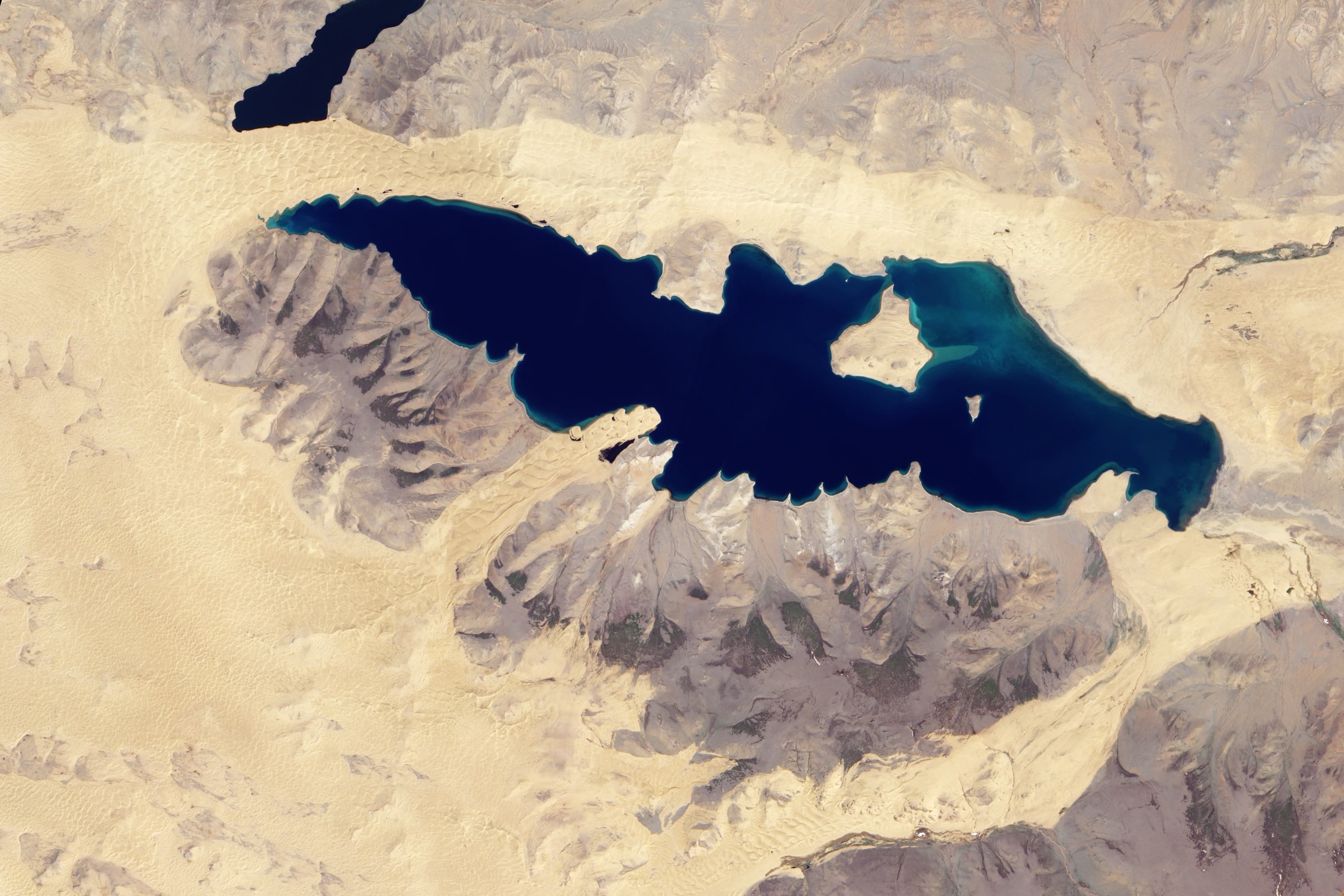
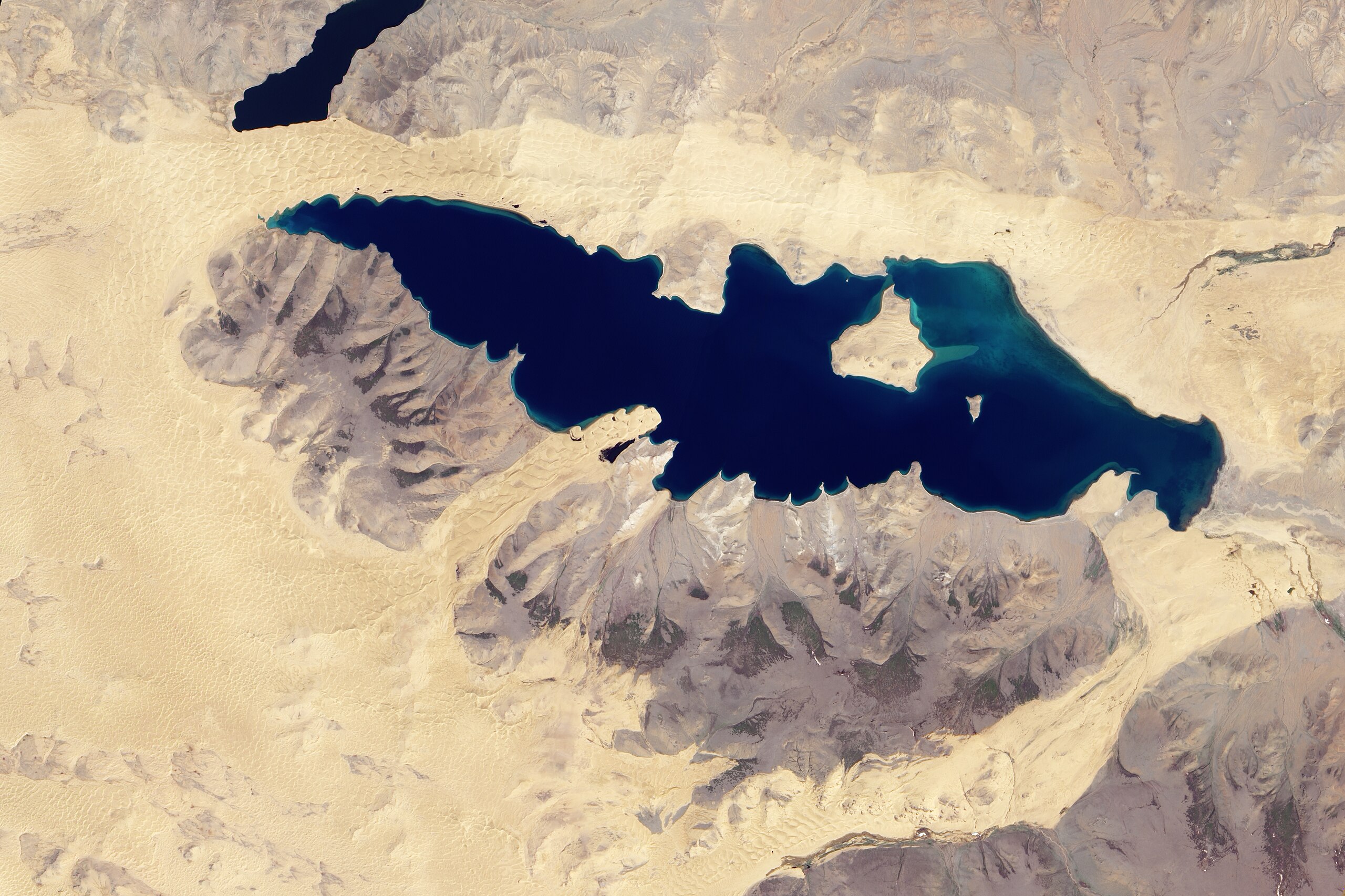
English: Natural-colour image of Har Nuur. Camel-coloured sand dunes ripple along the lake’s northern shore. Along the southern shore, sand dunes approach the lake in just two locations. A triangle-shaped expanse of sand borders Har Nuur in the east, and a tongue of sand intrudes into the lake in the west, pushing through a gap in the nearby mountains. All of the sane dunes, however, form part of a larger dune field nearly encircling the lake. |
| Date | |
| Source | NASA Earth Observatory |
| Author | Jesse Allen |
Image captured by the Advanced Land Imager (ALI) on NASA’s Earth Observing-1 (EO-1) satellite. EO-1 ALI data provided courtesy of the NASA EO-1 team.
Licensing
| This file is in the public domain in the United States because it was solely created by NASA. NASA copyright policy states that "NASA material is not protected by copyright unless noted". (See Template:PD-USGov, NASA copyright policy page or JPL Image Use Policy.) | ||
 |
Warnings:
|
File history
Click on a date/time to view the file as it appeared at that time.
| Date/Time | Thumbnail | Dimensions | User | Comment | |
|---|---|---|---|---|---|
| current | 10:43, 28 June 2010 | | 3,311 × 2,207 (4.04 MB) | Originalwana | {{Information |Description={{en|1=Natural-colour image of Har Nuur. Camel-coloured sand dunes ripple along the lake’s northern shore. Along the southern shore, sand dunes approach the lake in just two locations. A [[:Category:T |
File usage
The following pages on the English Wikipedia use this file (pages on other projects are not listed):
Global file usage
The following other wikis use this file:
- Usage on es.wikipedia.org