Size of this preview: 511 × 600 pixels. Other resolutions: 204 × 240 pixels | 409 × 480 pixels | 779 × 914 pixels.
Original file (779 × 914 pixels, file size: 365 KB, MIME type: image/png)
| This is a file from the Wikimedia Commons. Information from its description page there is shown below. Commons is a freely licensed media file repository. You can help. |
Summary
| Description |
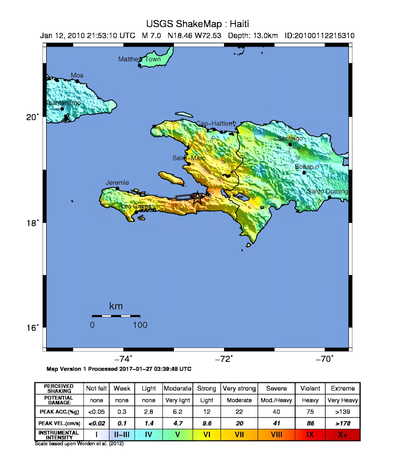
English: USGS ShakeMap of the 2010 Haiti earthquake. |
| Date | |
| Source | USGS |
| Author | USGS/Dancraggs |
| Other versions | 2010 haiti shake map.jpg |
Licensing
This image is in the public domain in the United States because it only contains materials that originally came from the United States Geological Survey, an agency of the United States Department of the Interior. For more information, see the official USGS copyright policy.
|
File history
Click on a date/time to view the file as it appeared at that time.
| Date/Time | Thumbnail | Dimensions | User | Comment | |
|---|---|---|---|---|---|
| current | 00:53, 3 February 2020 | | 779 × 914 (365 KB) | Tinh1000000 | ATLAS 2017-04-12 revision |
| 00:02, 23 January 2010 |  | 721 × 914 (211 KB) | AtomCrusher | {{Information |Description={{en|1=USGS ShakeMap v7, data re-rendered and anti-aliased by user.}} |Source=http://earthquake.usgs.gov/earthquakes/shakemap/global/shake/2010rja6/ |Author=USGS/Dancraggs |Date=2010-01-13 |Permission= |ot |
File usage
The following pages on the English Wikipedia use this file (pages on other projects are not listed):
Global file usage
The following other wikis use this file:
- Usage on ast.wikipedia.org
- Usage on az.wikipedia.org
- Usage on ca.wikipedia.org
- Usage on es.wikipedia.org
- Usage on eu.wikipedia.org
- Usage on ga.wikipedia.org
- Usage on it.wikipedia.org
- Usage on lad.wikipedia.org
- Usage on nn.wikipedia.org
- Usage on pt.wikipedia.org
- Usage on ru.wikipedia.org
- Usage on sk.wikipedia.org
- Usage on www.wikidata.org
- Usage on zh-min-nan.wikipedia.org
- Usage on zh.wikipedia.org