
Size of this preview: 279 × 600 pixels. Other resolutions: 111 × 240 pixels | 329 × 707 pixels.
Original file (329 × 707 pixels, file size: 29 KB, MIME type: image/gif)
| This is a file from the Wikimedia Commons. Information from its description page there is shown below. Commons is a freely licensed media file repository. You can help. |
| Description |
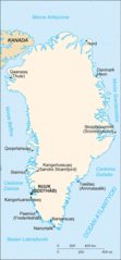
Polski: Spolszczona mapa Grenlandii z "CIA-The World Factbook". |
|||
| Source | CIA World Factbook - after modifications transferred from Polish Wikipedia. | |||
| Author | Central Intelligence Agency | |||
| Permission (Reusing this file) |
|

Original upload log
The original description page was here. All following user names refer to pl.wikipedia.
- 2004-11-02 22:43 Kuba G 329×707× (29525 bytes) spolszczona mapa Grenlandii z CIA The World Factbook
File history
Click on a date/time to view the file as it appeared at that time.
| Date/Time | Thumbnail | Dimensions | User | Comment | |
|---|---|---|---|---|---|
| current | 18:35, 21 December 2009 | | 329 × 707 (29 KB) | File Upload Bot (Magnus Manske) | {{BotMoveToCommons|pl.wikipedia|year={{subst:CURRENTYEAR}}|month={{subst:CURRENTMONTHNAME}}|day={{subst:CURRENTDAY}}}} {{Information |Description={{pl|Spolszczona mapa Grenlandii z "CIA-The World Factbook". Polish version of Geenland map from "CIA-The |
File usage
No pages on the English Wikipedia use this file (pages on other projects are not listed).
Global file usage
The following other wikis use this file: