Size of this preview: 425 × 599 pixels. Other resolutions: 170 × 240 pixels | 639 × 901 pixels.
Original file (639 × 901 pixels, file size: 169 KB, MIME type: image/jpeg)
File history
Click on a date/time to view the file as it appeared at that time.
| Date/Time | Thumbnail | Dimensions | User | Comment | |
|---|---|---|---|---|---|
| current | 12:58, 8 June 2014 |  | 639 × 901 (169 KB) | Hohum | Cleanup |
| 04:07, 18 December 2007 |  | 639 × 901 (127 KB) | Kelvinc | Cropped original map to show Grenada only. | |
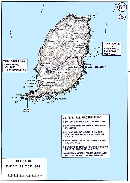
| 03:59, 18 December 2007 |  | 1,260 × 901 (157 KB) | Kelvinc | {{Information |Description=Invasion of Grenada by US and Caribbean nations, 1983. |Source=http://www.dean.usma.edu/history/web03/atlases/conflicts%2058%20west/conflicts%20west%20%20pages/wars%20conflicts%20west%20map%2052.htm |Date= |Author= |Permission= |
File usage
The following 2 pages use this file:
Global file usage
The following other wikis use this file:
- Usage on azb.wikipedia.org
- Usage on es.wikipedia.org
- Usage on fr.wikipedia.org
- Usage on www.wikidata.org
- Usage on zh.wikipedia.org
