Size of this preview: 547 × 599 pixels. Other resolutions: 219 × 240 pixels | 438 × 480 pixels | 701 × 768 pixels | 935 × 1,024 pixels | 1,285 × 1,408 pixels.
Original file (1,285 × 1,408 pixels, file size: 336 KB, MIME type: image/jpeg)
| This is a file from the Wikimedia Commons. Information from its description page there is shown below. Commons is a freely licensed media file repository. You can help. |
Summary
| Description |
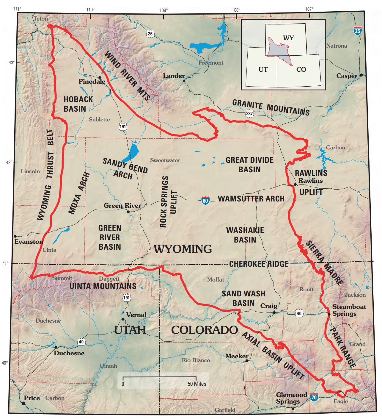
English: This is a map that shows the border of the Greater Green River Basin, along with the subbasins and archs that make up the overall basin. |
| Date | |
| Source |
https://pubs.usgs.gov/dds/dds-069/dds-069-d/reports.html Petroleum Systems and Geologic Assessment of Oil and Gas in the Southwestern Wyoming Province, Wyoming, Colorado, and Utah Chapter 1 |
| Author | USGS Southwestern Wyoming Province Assessment Team |
Licensing
This image is in the public domain in the United States because it only contains materials that originally came from the United States Geological Survey, an agency of the United States Department of the Interior. For more information, see the official USGS copyright policy.
|
File history
Click on a date/time to view the file as it appeared at that time.
| Date/Time | Thumbnail | Dimensions | User | Comment | |
|---|---|---|---|---|---|
| current | 19:48, 29 November 2018 | | 1,285 × 1,408 (336 KB) | Pgmou | User created page with UploadWizard |
File usage
The following pages on the English Wikipedia use this file (pages on other projects are not listed):
Global file usage
The following other wikis use this file:
- Usage on fr.wikipedia.org