Size of this preview: 347 × 599 pixels. Other resolutions: 139 × 240 pixels | 278 × 480 pixels | 444 × 768 pixels | 593 × 1,024 pixels | 1,185 × 2,048 pixels | 2,893 × 4,997 pixels.
Original file (2,893 × 4,997 pixels, file size: 266 KB, MIME type: image/png)
| This is a file from the Wikimedia Commons. Information from its description page there is shown below. Commons is a freely licensed media file repository. You can help. |
Summary
| Description |
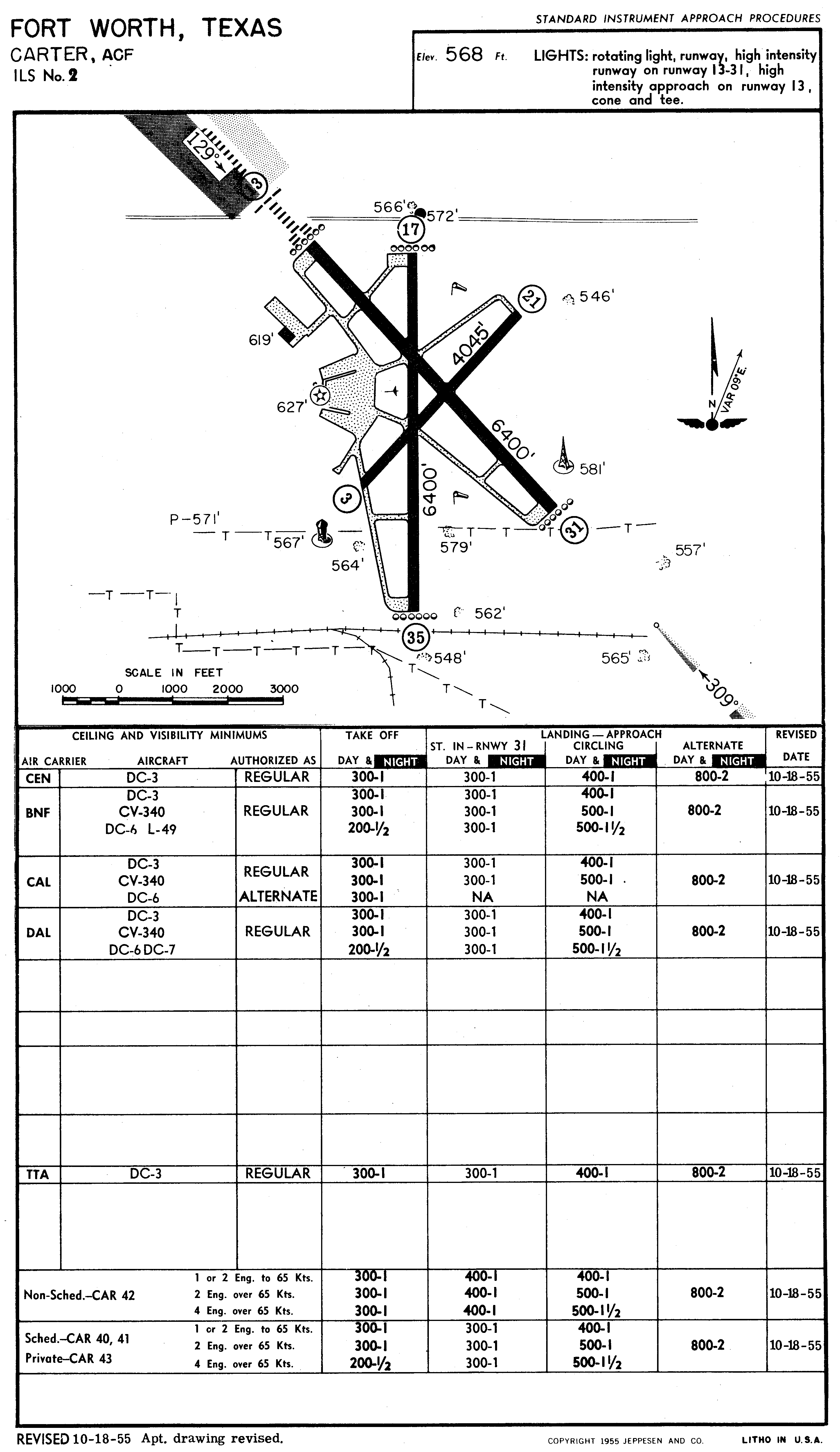
English: FAA airport diagram for the defunct en:Greater Southwest International Airport (GSW) serving Fort Worth, Texas, United States, as of 1955. |
|||
| Date | ||||
| Source | https://www.flickr.com/photos/12530375@N08/8038618604/sizes/h | |||
| Author | Federal Aviation Administration | |||
| Permission (Reusing this file) |
|

File history
Click on a date/time to view the file as it appeared at that time.
| Date/Time | Thumbnail | Dimensions | User | Comment | |
|---|---|---|---|---|---|
| current | 00:28, 5 May 2016 | | 2,893 × 4,997 (266 KB) | SilverbackNet | {{Information |Description ={{en|1={{en|FAA airport diagram for the defunct en:Greater Southwest International Airport (GSW) serving Fort Worth, Texas, United States, as of 1955.}}}} |Source =https://www.flickr.com/photos/12530375@N08/8... |
File usage
The following pages on the English Wikipedia use this file (pages on other projects are not listed):
Global file usage
The following other wikis use this file:
- Usage on de.wikipedia.org
- Usage on hu.wikipedia.org
- Usage on www.wikidata.org