Size of this preview: 800 × 370 pixels. Other resolutions: 320 × 148 pixels | 640 × 296 pixels | 1,357 × 628 pixels.
Original file (1,357 × 628 pixels, file size: 15 KB, MIME type: image/png)
| This is a file from the Wikimedia Commons. Information from its description page there is shown below. Commons is a freely licensed media file repository. You can help. |
Summary
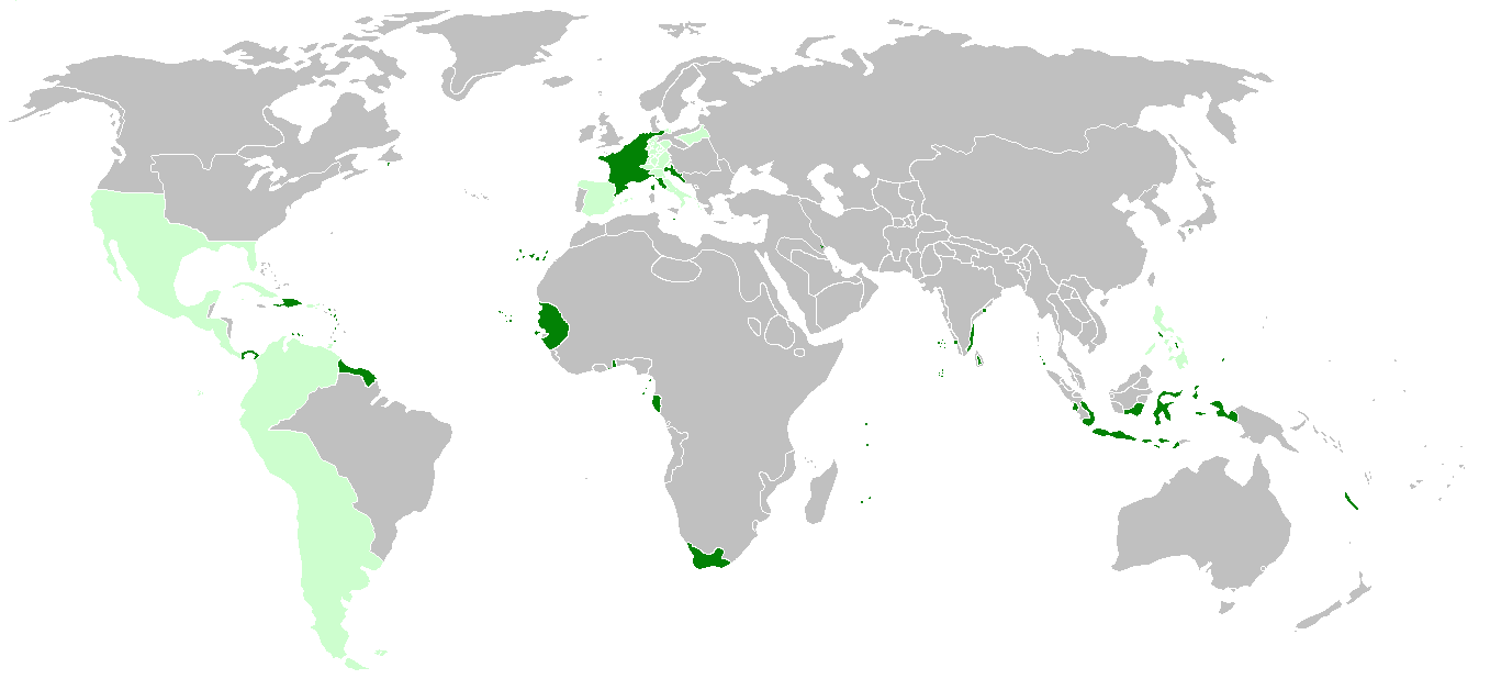
| Description | First French Empire before the french invasion of Russia on World 1812, with annexed or occupied colonies, satellite states, allied states and dependent colonies. | ||
| Date | |||
| Source | http://de.wikipedia.org/wiki/Erstes_Kaiserreich, napoleonská Francie a Evropa 1812 | ||
| Author | Hruska | ||
| Other versions |
|

Licensing
I, the copyright holder of this work, hereby publish it under the following license:
This file is licensed under the Creative Commons Attribution-Share Alike 3.0 Unported license.
- You are free:
- to share – to copy, distribute and transmit the work
- to remix – to adapt the work
- Under the following conditions:
- attribution – You must give appropriate credit, provide a link to the license, and indicate if changes were made. You may do so in any reasonable manner, but not in any way that suggests the licensor endorses you or your use.
- share alike – If you remix, transform, or build upon the material, you must distribute your contributions under the same or compatible license as the original.
File history
Click on a date/time to view the file as it appeared at that time.
| Date/Time | Thumbnail | Dimensions | User | Comment | |
|---|---|---|---|---|---|
| current | 23:51, 17 March 2022 | | 1,357 × 628 (15 KB) | M.Bitton | per [https://commons.wikimedia.org/w/index.php?title=Commons:Graphic_Lab/Map_workshop&oldid=640501111#Wrong_borders] |
| 21:08, 25 April 2021 |  | 1,357 × 628 (33 KB) | M.Bitton | Reverted to version as of 15:19, 6 December 2014 (UTC): If you don't want to be reported to the admins, I suggest you stop edit warring and read COM:OVERWRITE | |
| 14:58, 25 April 2021 |  | 1,357 × 628 (30 KB) | محمد٢ | Morocco wasn't a Spanish satellite state | |
| 22:04, 15 April 2021 |  | 1,357 × 628 (33 KB) | M.Bitton | Reverted to version as of 15:19, 6 December 2014 (UTC): per COM:OVERWRITE | |
| 21:37, 14 April 2021 |  | 1,357 × 628 (30 KB) | محمد٢ | Reverted to version as of 20:17, 14 April 2021 (UTC) | |
| 20:23, 14 April 2021 |  | 1,357 × 628 (30 KB) | محمد٢ | Reverted to version as of 18:02, 14 April 2021 (UTC) | |
| 20:17, 14 April 2021 |  | 1,357 × 628 (30 KB) | محمد٢ | border | |
| 18:02, 14 April 2021 |  | 1,357 × 628 (30 KB) | محمد٢ | border | |
| 15:19, 6 December 2014 |  | 1,357 × 628 (33 KB) | Hruska~commonswiki | broder | |
| 09:58, 6 December 2014 |  | 1,357 × 628 (33 KB) | Hruska~commonswiki | island |
File usage
The following pages on the English Wikipedia use this file (pages on other projects are not listed):
Global file usage
The following other wikis use this file:
- Usage on ar.wikipedia.org
- Usage on ast.wikipedia.org
- Usage on be.wikipedia.org
- Usage on br.wikipedia.org
- Usage on de.wikipedia.org
- Usage on el.wikipedia.org
- Usage on es.wikipedia.org
- Usage on eu.wikipedia.org
- Usage on fa.wikipedia.org
- Usage on fr.wikipedia.org
- Usage on hr.wikipedia.org
- Usage on id.wikipedia.org
- Usage on it.wikipedia.org
- Usage on ja.wikipedia.org
- Usage on kk.wikipedia.org
- Usage on lt.wikipedia.org
- Usage on mn.wikipedia.org
- Usage on ms.wikipedia.org
- Usage on mt.wikipedia.org
- Usage on rm.wikipedia.org
- Usage on th.wikipedia.org
- Usage on uk.wikipedia.org
- Usage on vi.wikipedia.org
- Usage on www.wikidata.org
- Usage on zh.wikipedia.org