Size of this preview: 800 × 533 pixels. Other resolutions: 320 × 213 pixels | 640 × 427 pixels | 1,024 × 683 pixels | 1,280 × 853 pixels | 2,400 × 1,600 pixels.
Original file (2,400 × 1,600 pixels, file size: 639 KB, MIME type: image/jpeg)
| This is a file from the Wikimedia Commons. Information from its description page there is shown below. Commons is a freely licensed media file repository. You can help. |
Summary
| Description |
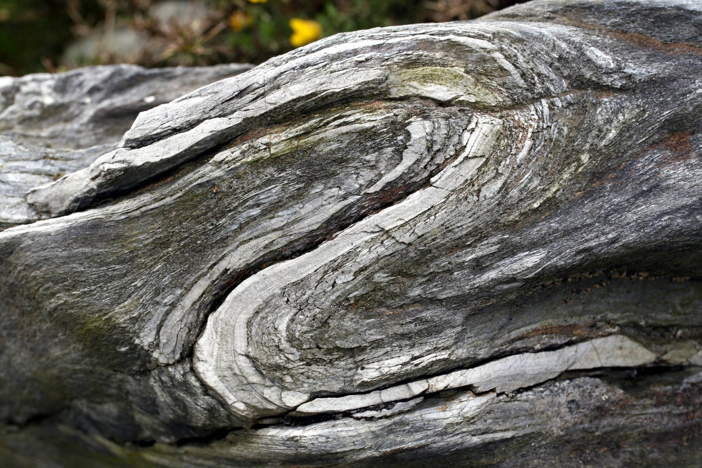
English: Folds in rocks of the hills of the Monts d'Arrée, near Commana in the department of Finistère in Brittany, France. These are small Z-folds or S-folds (depending on which direction they are viewed) on the limbs of a larger fold. The view is about 10 centimetres across. The dark-coloured rock is schist of the Plougastel Formation, of Paleozoic age, with bands of white quartzite. |
| Date | |
| Source | http://www.geodiversite.net/media1101 |
| Author | zarmel http://www.geodiversite.net/auteur2 |
| Camera location | | View this and other nearby images on: OpenStreetMap |
|---|
Licensing
This file is licensed under the Creative Commons Attribution-Share Alike 3.0 Unported license.
- You are free:
- to share – to copy, distribute and transmit the work
- to remix – to adapt the work
- Under the following conditions:
- attribution – You must give appropriate credit, provide a link to the license, and indicate if changes were made. You may do so in any reasonable manner, but not in any way that suggests the licensor endorses you or your use.
- share alike – If you remix, transform, or build upon the material, you must distribute your contributions under the same or compatible license as the original.
This file, which was originally posted to
http://www.geodiversite.net/media1101, was reviewed on 24 January 2015 by reviewer Thibaut120094, who confirmed that it was available there under the stated license on that date.
|
File history
Click on a date/time to view the file as it appeared at that time.
| Date/Time | Thumbnail | Dimensions | User | Comment | |
|---|---|---|---|---|---|
| current | 01:18, 24 January 2015 | | 2,400 × 1,600 (639 KB) | GeoWriter | User created page with UploadWizard |
File usage
The following pages on the English Wikipedia use this file (pages on other projects are not listed):
Global file usage
The following other wikis use this file:
- Usage on arz.wikipedia.org