
Size of this PNG preview of this SVG file: 415 × 422 pixels. Other resolutions: 236 × 240 pixels | 472 × 480 pixels | 755 × 768 pixels | 1,007 × 1,024 pixels | 2,014 × 2,048 pixels.
Original file (SVG file, nominally 415 × 422 pixels, file size: 89 KB)
| This is a file from the Wikimedia Commons. Information from its description page there is shown below. Commons is a freely licensed media file repository. You can help. |

.jpg)
Summary
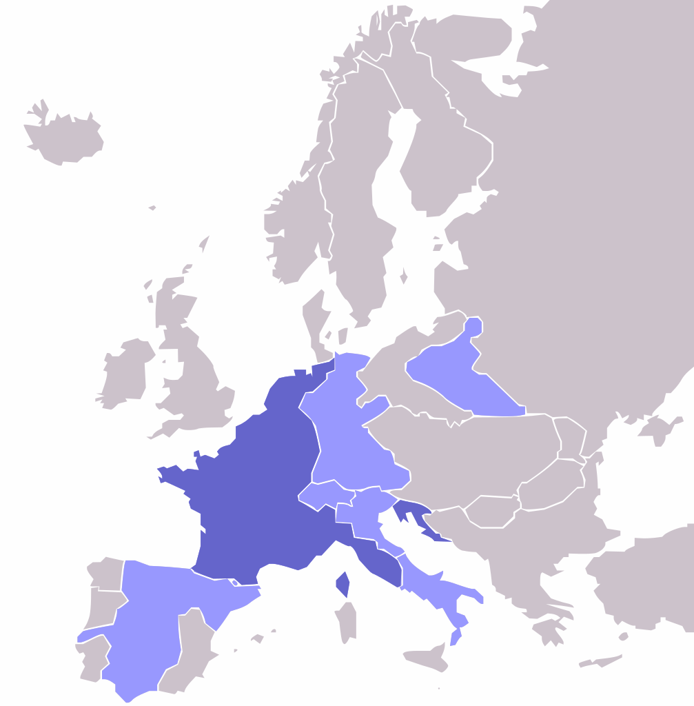
| Description | Map of the w:First French Empire and satellite states, with w:1811 borders. Created by User:OwenBlacker from Image:Europe blank map.png, therefore they are the source. |
| Date | (UTC) |
| Source | |
| Author |
|
| Other versions | File:Europe map Napoleon 1811.png |
Licensing
| I, the copyright holder of this work, release this work into the public domain. This applies worldwide. In some countries this may not be legally possible; if so: I grant anyone the right to use this work for any purpose, without any conditions, unless such conditions are required by law. |
Original upload log
This image is a derivative work of the following images:
- File:Europe_map_Napoleon_1811.png licensed with PD-self
- 2006-10-16T00:53:12Z Deltabeignet 415x422 (13615 Bytes) Corrected status of Illyrian provinces.
- 2005-08-21T00:51:11Z OwenBlacker 415x422 (11762 Bytes) Map of the [[w:First French Empire]] and satellite states, with [[w:1811]] borders. Created by [[User:OwenBlacker]] from [[:Image:Europe blank map.png]] {{GFDL}} {{cc-by-sa-2.0-uk}}
Uploaded with derivativeFX
| Annotations | This image is annotated: View the annotations at Commons |
File history
Click on a date/time to view the file as it appeared at that time.
| Date/Time | Thumbnail | Dimensions | User | Comment | |
|---|---|---|---|---|---|
| current | 23:14, 2 May 2009 | | 415 × 422 (89 KB) | Mnmazur | {{Information |Description=Map of the w:First French Empire and satellite states, with w:1811 borders. Created by User:OwenBlacker from Image:Europe blank map.png, therefore they are the source. |Source=*[[:File:Europe_map_Napoleon_1811.p |
File usage
No pages on the English Wikipedia use this file (pages on other projects are not listed).
Global file usage
The following other wikis use this file:
- Usage on ba.wikipedia.org
- Usage on es.wikipedia.org
- Usage on et.wikipedia.org
- Usage on fr.wikipedia.org
- Usage on hi.wikipedia.org
- Usage on hu.wikipedia.org
- Usage on hy.wikipedia.org
- Usage on no.wikipedia.org
- Usage on pl.wikipedia.org
- Usage on ru.wikipedia.org
- Usage on sr.wikipedia.org
- Usage on sv.wikipedia.org
- Usage on tl.wikipedia.org
- Usage on tt.wikipedia.org
- Usage on uk.wikipedia.org
- Usage on yo.wikipedia.org
- Usage on zh-min-nan.wikipedia.org