No higher resolution available.
ElkhornTornadoPath.png (528 × 524 pixels, file size: 274 KB, MIME type: image/png)
| This is a file from the Wikimedia Commons. Information from its description page there is shown below. Commons is a freely licensed media file repository. You can help. |
Summary
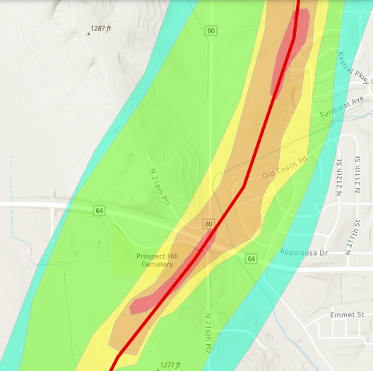
| Description |
English: The path of the Elkhorn, NE EF4 tornado in Elkhorn, with EF contour polygons overlaid. |
| Date | |
| Source | https://apps.dat.noaa.gov/StormDamage/DamageViewer/ |
| Author | National Oceanic and Atmospheric Administration |
Licensing
This file is in the public domain in the United States because it was solely created by employees of the National Weather Service or National Severe Storms Laboratory using the Damage Assessment Toolkit (DAT), an interactive map and database.
|
File history
Click on a date/time to view the file as it appeared at that time.
| Date/Time | Thumbnail | Dimensions | User | Comment | |
|---|---|---|---|---|---|
| current | 03:07, 31 July 2024 | | 528 × 524 (274 KB) | Nicholas Krasznavolgyi | Uploaded a work by National Oceanic and Atmospheric Administration from https://apps.dat.noaa.gov/StormDamage/DamageViewer/ with UploadWizard |
File usage
The following pages on the English Wikipedia use this file (pages on other projects are not listed):